PROJECT

Natural Flood Management in the Medway

Natural Flood Management (NFM) is a pioneering technique that imitates natural processes to reduce flood risk downstream. Working with 10 local landowners, we implemented NFM measures across four sites to help reduce flood risk and protect communities.

This project was delivered with funding from the EU Interreg North Sea FRAMES project, Maidstone Borough Council, Defra and the Environment Agency. It is part of a programme of Natural Flood Management projects being delivered through the Medway Flood Partnership across the Medway catchment to help improve our understanding of these techniques, manage flood risk and deliver wider environmental benefits.


  • leaky wood structures (LWS) installed

    200

  • cubic metres of flood storage created

    3200

  • square metres of wetland habitat created

    6000

  • hectares of enhanced priority habitats

    20

How does NFM work?

NFM uses natural materials to slow the flow of water, reducing the chance of flash flooding, as well as increasing water storage throughout the landscape.

Example NFM measures include tree planting, the creation of temporary water storage areas, and leaky dams. These are all designed to slow water as it travels downstream reducing the flood peak.

NFM holding water back © South East Rivers Trust

Working with data

SCIMAP is a mapping tool originally developed to map diffuse pollution risk within a catchment. It uses topography and land use data to identify pollution sources and their connectivity to a waterbody such as a river.

For NFM, this hydrological connectivity can be used to identify potential flow paths within a river catchment. The SCIMAP (right) is from the School Stream, a tributary of the River Medway. This has been used to guide site visits and the placement of NFM interventions to intercept the key flow paths, and reduce the flood peak downstream.

In addition to SCIMAP, flood-affected communities worked with us to show our staff where flooding occurred and known flow pathways across the landscape.

Mapping issues © South East Rivers Trust

Site 1: Sissinghurst Castle and Gardens

We restored a floodplain water meadow, working closely with the National Trust.

A scrape (a hollowed-out area of land) was dug and an off-take channel from the stream was installed to fill it in periods of high flows. A drain at the bottom of the scrape allows water to pass slowly back into the stream, reducing the flood peak in the Hammer Stream.

Approximately 2.3 hectares of lowland meadow habitat were created with this project, attracting wetland birds such as little egret, snipe and teal as well as further expanding the healthy dragonfly population.

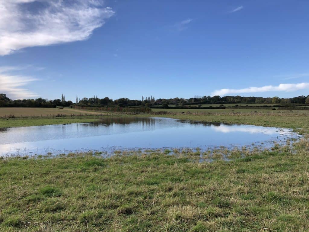
Sissinghurst Natural Flood Storage © South East Rivers Trust

Site 2: Bedgebury National Pinetum and Forest

We worked in partnership with the Forestry Commission to build NFM features in Bedgebury Forest. 

1500 m3 of flood storage was created by installing 60 Leaky Woody Structure (LWS) through the forest.

LWS act as natural barriers, holding back water which then slowly leaks out, reducing the flood peak downstream.

With the LWS holding back large volumes of water, two hectares of wetland along a 2km stretch of river have since formed. The wetland habitat has been rapidly colonised by a range of fungi, aquatic plants and animals, including smooth newts and common frogs.


Large woody structure © South East Rivers Trust

Site 3: The Alder Stream

The Alder Stream is a tributary of the River Medway in Kent. The stream’s clay geology and steep valleys leave it highly susceptible to flashy floods, impacting the downstream village of Five Oak Green.

To help protect homes, we:

  • Installed 90 LWS along the stream to hold back water and reduce the flood peak.
  • Fenced 11 hectares of degraded ancient woodland to prevent grazing and allow vegetation to recover – all of which will help intercept rainwater in future years.
Large Woody Structure © South East Rivers Trust

Site 4: The School Stream

The School Stream is a tributary of the River Beult in Kent. Another clay catchment, the School Stream is also highly susceptible to flashy floods, impacting the downstream village of Headcorn.

To help protect homes, we installed 25 LWS along the stream and constructed a pond in the headwaters of the catchment which captured high flows providing 600 m3 of flood storage.

The pond provides multiple benefits. Diverting water through the pond allows sediment to settle out of the water, improving the quality of water that continues downstream.

Ponds also provide a biodiverse aquatic habitat. More than 20 species of plant colonised the pond from the seedbank the following year.

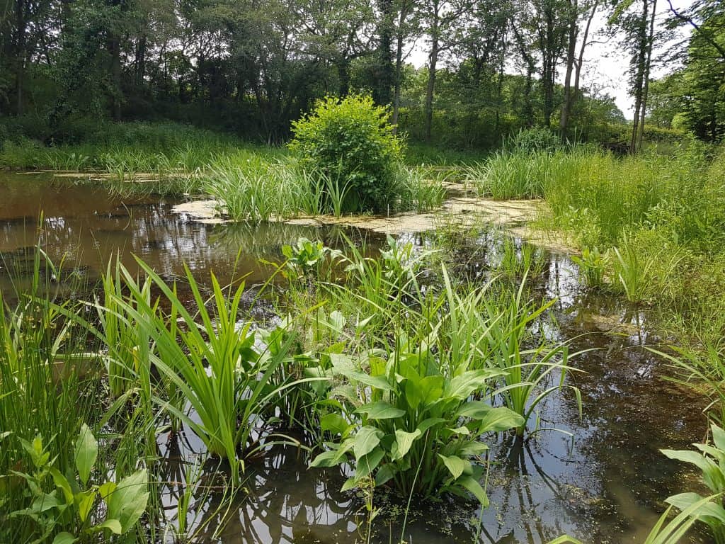
Kingsnoad Flood Storage © South East Rivers Trust
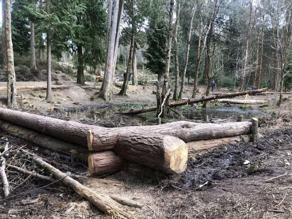
Does NFM work?

NFM techniques are still relatively new and we are working with partners to monitor the effectiveness of NFM interventions at a sub-catchment scale.

Monitoring includes traditional methods such as flow meters and level loggers, as well as mobilising citizen scientists and trialling innovative monitoring equipment such as Free Stations.

Monitoring natural flood management © South East Rivers Trust

Case studies

We produced a series of case studies to support other practitioners, landowners and partners in finding out more about our natural flood management interventions on the Medway. Please feel free to download these and share with anyone who might be interested.

Medway NFM Overview

Alder Stream

School Stream

Sissinghurst Castle

Bedgebury Forest

Read the final full report below – recommended for partners and practitioners.

Medway NFM Final Report

NFM holding water back © South East Rivers Trust

Thanks to our supporters

FRAMES
Forestry England
Hadlow Estate
Maidstone Borough Council
Medway Flood Partnership
South East Water
Environment Agency logo