Chamber Mead wetland community planting day – Hogsmill River

Chamber Mead wetland community planting day – Hogsmill River

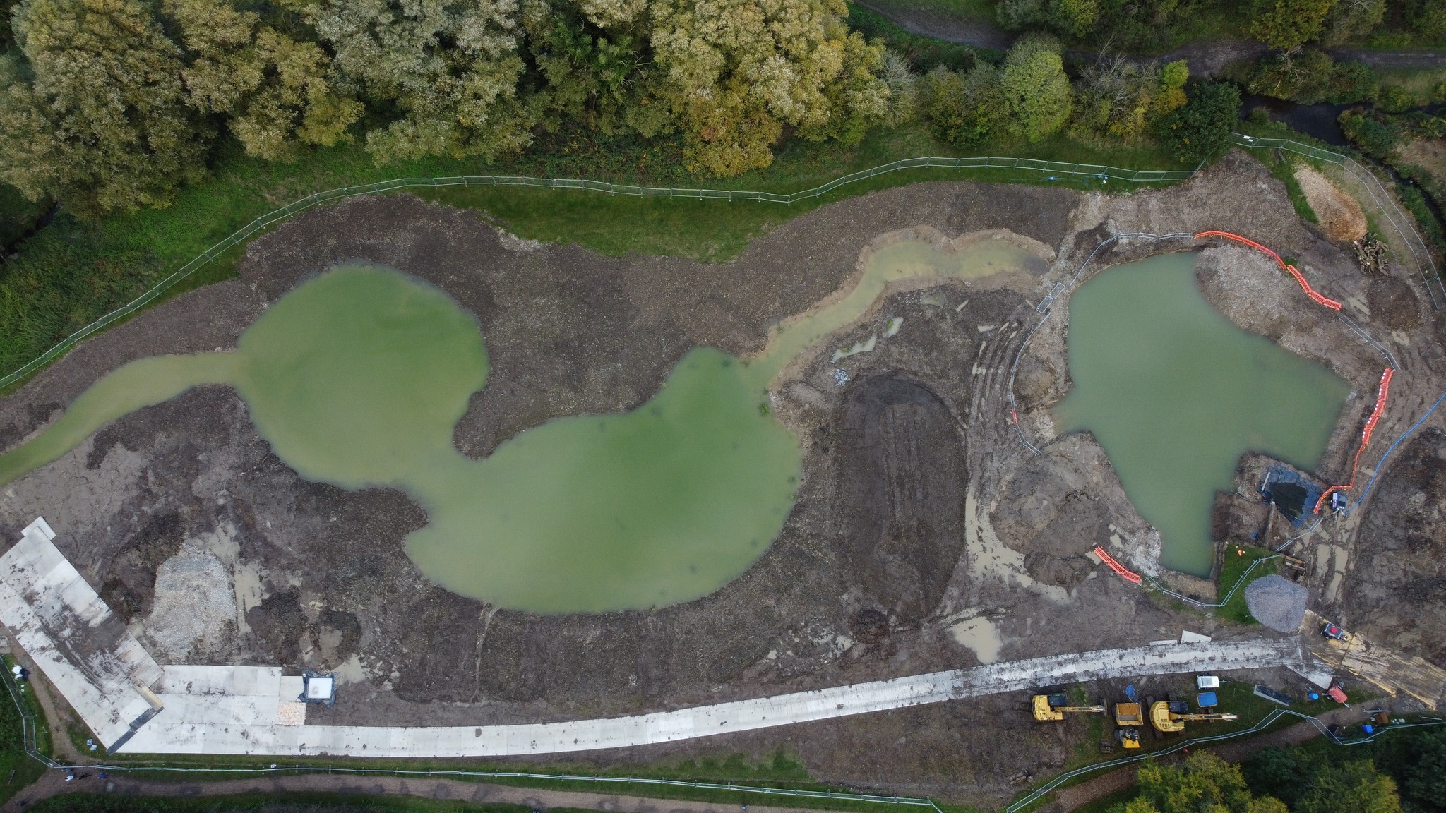
Activity Description: Join us at the recently constructed Chamber Mead wetland to help plant a range of native wetland plants. Once established, these plants will help to filter pollutants from the water and will provide food, shelter and habitat for local wildlife.

Meeting point: Meet at the entrance to Chamber Mead, just off Green Lanes, Ewell, KT19 9SZ. Google map HERE

What to bring: Please wear appropriate clothes and footwear. The site may be very muddy, you might wish to wear your own walking shoes/wellies but we might be working in shallow water and will provide wellies and waders if required. We will provide tea, coffee and biscuits but please bring your own lunch and water.

BOOKING ESSENTIAL – please rsvp using the button below and complete the form to secure your spot. If the event is already fully booked then please sign yourself up to the waiting list and we’ll be in touch if a space becomes available.

Booking for this event will close at 5pm on Friday 26th April.

Please note: The event may finish early if all of the plants have been planted!

Please email volunteering@southeastriverstrust.org to:

  • Find out more information,
  • Cancel your space if you can no longer make it.

To read our Health and Safety Guidelines for this event please click HERE.

Photos and video footage will be taken at this event and used by the Trust for promotional purposes (including but not limited to printed materials, social media, newsletters and the website) and potentially shared with our external partners and funders. From time to time, external media agencies could also take photos, film or record our events.

The Trust’s lawful basis for processing this is “Legitimate Interests” under the General Data Protection Regulations. As an individual you have rights. If you wish for SERT to stop processing this data for you, please talk to a member of staff or email info@southeastriverstrust.org.

To read our Privacy Policy and see how we use and look after the information you provide when booking your spot at our events please click HERE.

SERT is committed to becoming a more inclusive, equal and diverse organisation. We value people as individuals with diverse opinions, cultures, lifestyles and circumstances. This applies to our event attendees and volunteers as well as all our staff, trustees and job applicants. To help us maintain accurate data about who is coming to our events, we would be grateful if you would spend a couple of minutes completing our Equality, Diversity and Inclusion Questionnaire by clicking HERE. Completing this form is voluntary, and any data you submit will be held securely and only used for the purpose of monitoring our organisational profile.

Volunteers test pollution levels on River Mole

Volunteers are now collecting vital data about the health of the River Mole, after being given water quality testing kits as part of our Mending the Upper Mole project.

We are thrilled to have teamed up with River Mole River Watch, a local charity group which shares our aim to bring the river back to life for wildlife and people to enjoy.

Lewis briefs the volunteers on how to use the kits to test for pollution on the River Mole

Having picked up their kits this week, the citizen scientists will now be carrying out monthly tests for the next two years, to give us a baseline of pollutants. The volunteers will be measuring 10 aspects of river health, including levels of phosphate, ammonia, nitrate, conductivity, pH for acidity and temperature. All of this data is crucial to help us understand how to improve the river.

Lewis Campbell, SERT’s Catchment Manager in charge of the Mending the Upper Mole project, said: “It is fantastic to have a group of volunteers who want to get into the nitty gritty of looking after their local river by carrying out water quality tests to assess pollution levels. We know River Mole River Watch play an active part in caring for their stretch of river and it is brilliant to team up with them as they do so.

“The volunteers will be helping the Mending the Upper Mole project to assess the health of this section of river in a way that has not been done before. The results will allow us to highlight hotspots of pollution, helping the catchment partnership to implement strategies to  combat pollution and help the catchment thrive. We have already added gravels to the river at Maidenbower to help fish and we are working on a number of other projects to improve the waterway for wildlife.”

Simon Collins, one of the Trustees of River Mole River Watch, said: “Our fantastic River Mole River Watch volunteers have been collecting water quality test data across the whole catchment every month for a year. Partnering with SERT has been very helpful indeed and we are excited by the Mending the Upper Mole project as it focusses on water quality and pollution in the Upper Mole which is a particularly sensitive part of the river catchment area. More data will help to identify hot spots and areas we can work with SERT to improve.”

The River Mole catchment partnership is co-hosted between SERT and Surrey Wildlife Trust and the vision is set out on the river network’s Storymap website. The Water Framework Directive status for the water quality in the area being assessed is rated “poor”. The area being measured starts close to the source of the Stanford Brook and encompasses much of the Gatwick Stream.

So what are we measuring and why?

The water quality testing kits that will be used by volunteers

Self-contained testing kits will allow volunteers to monitor levels of chemicals such as phosphates and nitrates. High levels of both nutrients lead to algae growing in the water, depleting oxygen levels and obstructing light making the river unsuitable habitat for other wildlife. High phosphate readings would indicate pollution has likely occurred from untreated sewage – or domestic, misconnected plumbing that bypasses sewage treatment works and goes straight into rivers form surface water drains, known as outfalls.

Another chemical tested for will be ammonia, high levels of which would suggest pollution is coming from either sewage or agriculture. Conductivity measurements will also be taken to identify the presence of salts and heavy metals, indicators of road run-off washed into the river. A temperature reading will also be taken and higher readings are likely to be an indication of spillages from outfalls.


Volunteers with their kits
Volunteers from River Mole River Watch receive water quality testing kits to test for pollution

Volunteer to tackle pollution on the Beverley Brook

Do you see pollution in the Beverley Brook and want to do something about it? Did you know that misconnected household plumbing is sending sewage water straight into our precious waterways?

Rivers should be healthy spaces for wildlife and places people can enjoy, but they are plagued by pollution – some of it coming straight from our homes.

This spring, you can become a citizen scientist and help us identify, map and assess polluted outfalls along the river, which rises in Cuddington Park, Stoneleigh, and passes through New Malden, Wimbledon Common and Richmond Park. This is all in partnership with Zoological Society of London (ZSL) for the latest round of their Outfall Safari programme.

A polluted drain spills into a river

Solving the problem of misconnections

Our drainage network is serviced by two systems. One collects rainwater and flows directly into rivers. The other takes foul wastewater from buildings to sewage treatment works to be cleaned first.

When appliances such as washing machines, sinks or toilets are incorrectly connected into the rainwater drainage system, this pollution spills directly into rivers. Signs of these plumbing misconnections can be as obvious as detergents or waste from toilets appearing in the water. These misconnections can become a chronic source of pollution with serious impacts on water quality and wildlife.

In 2016, ZSL created a method to survey London’s rivers to identify and report polluting drains. Before then, the scale of the issue was completely unknown. Now the method is used nationwide.

The results from volunteer surveys are reported via an App to the Environment Agency and Thames Water. The water company then addresses the misconnected plumbing with property owners or local councils.

What difference has it made?

Volunteers will learn to understand and identify pollution from drains on the Pyl Brook

Outfall Safaris on the Beverley Brook were last conducted in 2019. Then, 57 out of 196 drains (29%) were found to be spilling pollution into the nine miles of river which includes the East Pyl and Pyl Brook tributaries.

Emma Broadbent, Volunteer and Engagement Officer at the South East Rivers Trust, said: “We’re excited to be focusing on the Beverley Brook, because last time our volunteers surveyed the river they found a high number of polluting outfalls. We are eager to find out what the situation is now, five years on.

“We know from the work on other rivers that Outfall Safaris really work. Last year, we surveyed the Wandle, finding just nine polluting outfalls from 135 drains, compared to 2019 when we found 16 that were polluting the river. Signing up to take part is a valuable way for any river lover to make a difference.”

During training, participants will gain an overview of water quality issues in the catchment, learn how outfalls become polluted and will be given full instructions on how to assess them and report them via bankside surveys. There is no need to enter the water.

How do you get involved?

Training takes place on Wednesday 20th March from 1.30pm to 3.30pm at Worcester Park Library, Stone Place, Windsor Road, Worcester Park, KT4 8ES. Sign up here.

Participants must be aged 18 or over, attend the training in person and be able to commit to carrying out the Outfall Safaris in March and April. Specifically, you will need to be able to conduct surveys during dry periods, at least 48 hours after wet weather. This is to ensure any pollution is not masked or diluted by rainwater drainage.

Across London and the South East of England, Thames Water, ZSL and local volunteers have prevented 4,243 misconnected appliances from polluting watercourses: 23% of them were washing machines and 21% kitchen sinks.

If you have further questions email Sam Facey, ZSL’s training co-ordinator.

Outfall Safari – Beverley Brook

We are looking for volunteers to help conduct Outfall Safari surveys along the Beverley Brook. This involves bankside surveys of stretches of the brook to map and record the impact of outfalls.

The surveys will take place during March-April 2024.

As a volunteer, you can choose which stretch of the river and at what time to conduct the survey, within the survey period.

The survey will be conducted from the riverside path, in areas that are accessible and where the river is easily visible. Training will be provided by ZSL.

The training session will take place at:

Worcester Park Library, Stone Place, Windsor Road, Worcester Park, KT4 8ES,
on Wednesday 20th March 13:30-15:30. 

BOOKING ESSENTIAL – please book your space by clicking HERE 

Once registered, more information will be sent to you about how to join the training.

For more information please email: sam.facey@zsl.org

New online tool highlights nature-based solutions to tackle road runoff

A new online tool has been launched this week to help tackle road runoff pollution in London’s rivers by highlighting the best places to install nature-based solutions such as wetlands.

The development of the first-of-its-kind tool by Thames21 builds on years of research by the environmental charity and its partners Middlesex University and the South East Rivers Trust, which contributed with mapping, scoping and reporting.

Pollution from our roads adds to a number of problems for our rivers coming from sewer overflows, litter and misconnected drains. However it is often the Cinderella of pollution topics, because it receives far less public attention than sewage or agricultural causes.

Research from the Rivers Trust shows that the UK’s 1,600 rivers are affected by a cocktail of chemicals that are speeding up aquatic nature-loss, affecting insects, birds and mammals.

Road runoff goes straight to rivers

Road runoff can contain residue from oil spills, as well as tyre and brake wear from vehicles. These build up during dry weather and are then washed into rivers and streams when it rains.

The new tool will help decision makers prioritise the right water quality improvements:

  • in greenspaces that lie between the road and the river
  • at road locations in Outer London where surface water drains to the rivers; and
  • on London’s main strategic road network (includes Transport for London’s roads and some sections of National Highways’ and local authority roads)

Thames21 started its initial road runoff project identifying key polluting roads in 2019, with funding from the Mayor of London, Transport for London, and the Environment Agency. The British Geological Survey built the online decision support tool ‘Road Pollution Solutions’ and provided some additional support through the UKRI NERC-funded CAMELLIA project.

The South East Rivers Trust contributed research on sites in South London, including Surbiton, using its GIS mapping technology and catchment-based approach, identifying places where solutions such as wetlands could be built to counter the pollutants. By providing a natural barrier and filter using nature-based solutions, some of this road runoff pollution can be captured and prevented from entering rivers in the first place.

Users of the tool can search different boroughs, pinpoint particular areas and see just how polluting they are. This will help to prioritise where solutions could be put in place as mitigation. The tool shows the location of rivers, sewage outfalls and areas that drain into waterways.

Online road runoff tool example
An example of how the road runoff solutions user guide works

Modelling has shown that 2,415 road sections covering a total of 451.43km of London’s roads assessed pose a high risk of causing road runoff and are therefore a priority. Roads where heavy goods vehicles regularly apply their brakes are often the worst affected.

Community groups can also easily see pollution hotspots and help to suggest solutions by working for example with the authorities or through catchment partnerships.

The tool – which extends to all outer London boroughs – allows uses to access data by boroughs or river catchment and includes the Wandle, Beverley Brook, Hogsmill, Upper Darent, Lower Cray and Upper Cray.

Working in partnership, authorities responsible for these roads could intervene by providing nature-based solutions in these areas to help make runoff cleaner, and improve water quality in local rivers and watercourses.

Find out how the tool works by reading the user guide.

Statement on Thames Water fine for pollution near Gatwick

The South East Rivers Trust notes today’s judgement at Lewes Crown Court that Thames Water has been fined £3.3million for polluting a section of the River Mole near Gatwick Airport on October 11, 2017.

About 1,400 fish were killed in the incident on the River Mole between Crawley in Sussex and Horley in Surrey.

In a statement, SERT said:

“There is no excuse for polluting rivers which are the lifeblood of our landscapes. This incident decimated fish populations on the Gatwick Stream and impacted the ecology of the river far beyond into the catchment of the River Mole.

“Six years after this pollution incident the river and local angling club are still suffering.

“We welcome Thames Water’s fine, while hoping it would have been higher.

“We are furious to hear the Judge’s conclusion that Thames Water attempted to mislead the regulator.

“They have asked to work with us to help repair the damage by providing £1m in the form of a voluntary reparation to help improve the river’s habitat and water quality that is so important to the local community.”

SERT is already using the voluntary reparation to improve the health and resilience of the Gatwick Stream and other waterways impacted by this pollution event.

The money is being used to fund projects, such as the Caring for Crawley’s Rivers project, that improve the quality of the river habitat, identify and remedy systematic water quality issues in the catchment, and engage local communities in the health of their rivers, including carrying out education sessions.

SERT will also be working to gather data and evidence to support the development and deployment of these remediation projects and to monitor their success.