Helping reduce flood risk through nature
Natural Flood Management (NFM) uses natural processes to slow, store and filter water across the landscape, helping to reduce flood risk for downstream communities while creating valuable habitats for wildlife.
Working with 10 landowners and partners across the Medway catchment, we delivered a range of NFM measures across four sites in Kent. The project formed part of the wider Medway Flood Partnership programme and was funded by the EU Interreg North Sea FRAMES project, Maidstone Borough Council, Defra and the Environment Agency.
How Natural Flood Management works
Natural Flood Management helps rivers and landscapes function more naturally by slowing the movement of water during heavy rainfall.
Measures can include:
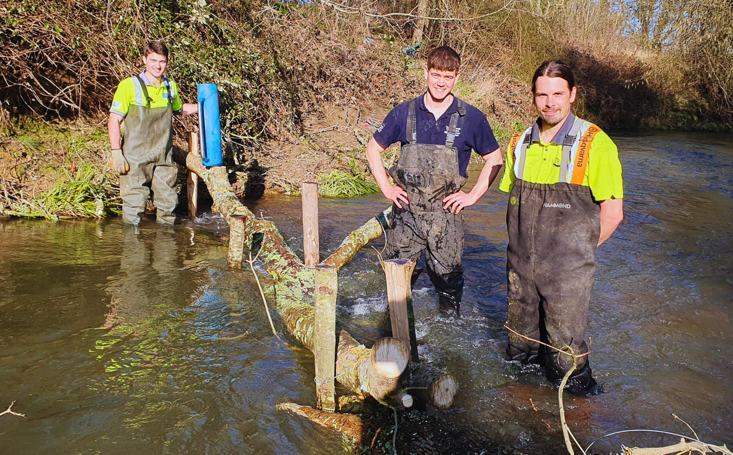
- Leaky wood structures that temporarily hold back water
- Wetland and pond creation
- Floodplain reconnection
- Tree and hedgerow planting
- Scrapes and bunds that provide temporary water storage
These interventions reduce peak flows, increase water storage across the catchment and deliver wider benefits for biodiversity, water quality and climate resilience.
Using data to target action
We used a mapping tool called SCIMAP to identify how water moves through the landscape and where interventions would have the greatest impact.
This data was combined with local knowledge from flood-affected communities to identify key flow pathways and prioritise locations for Natural Flood Management measures.
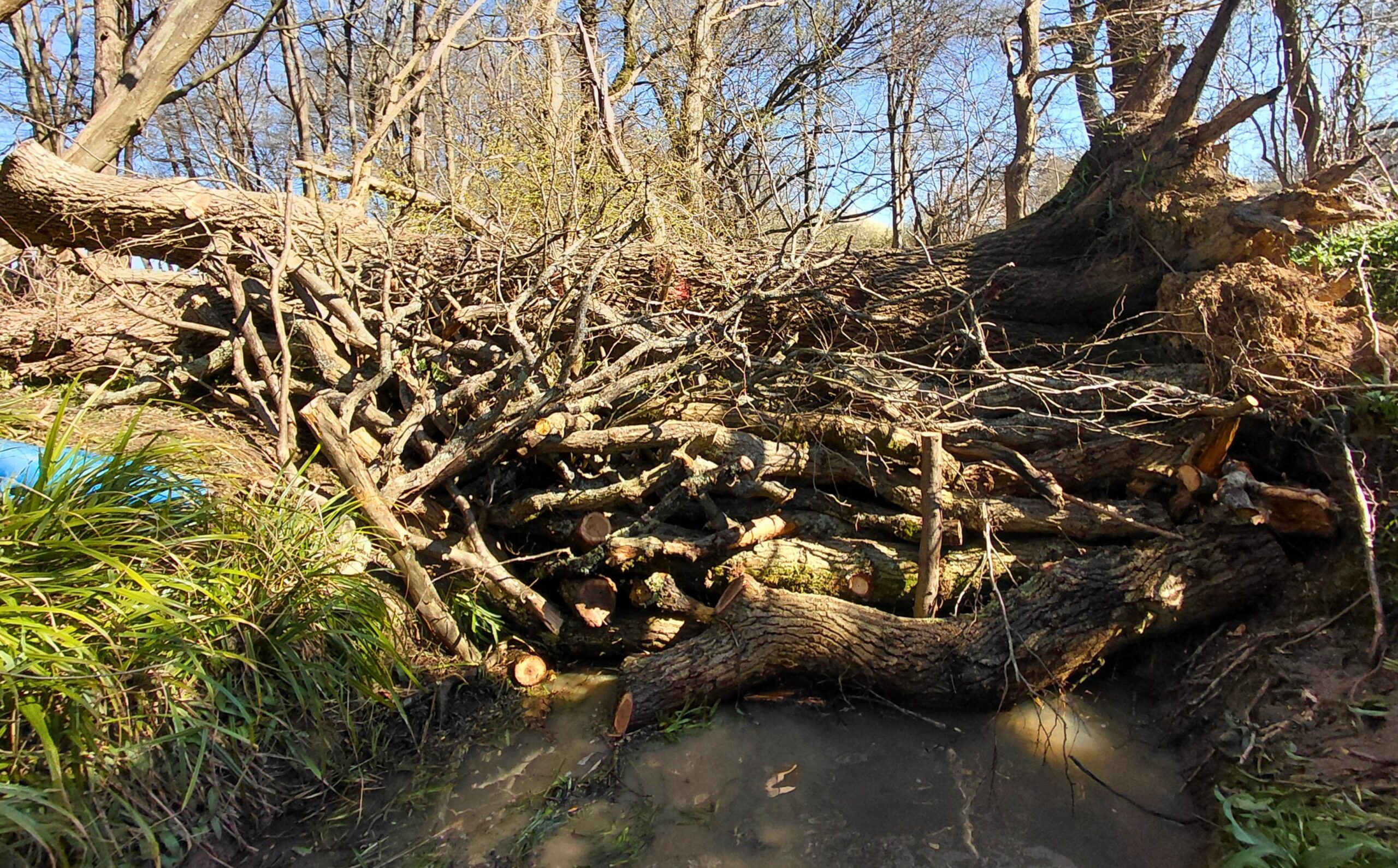
A leaky woody dam © South East Rivers Trust
Project highlights
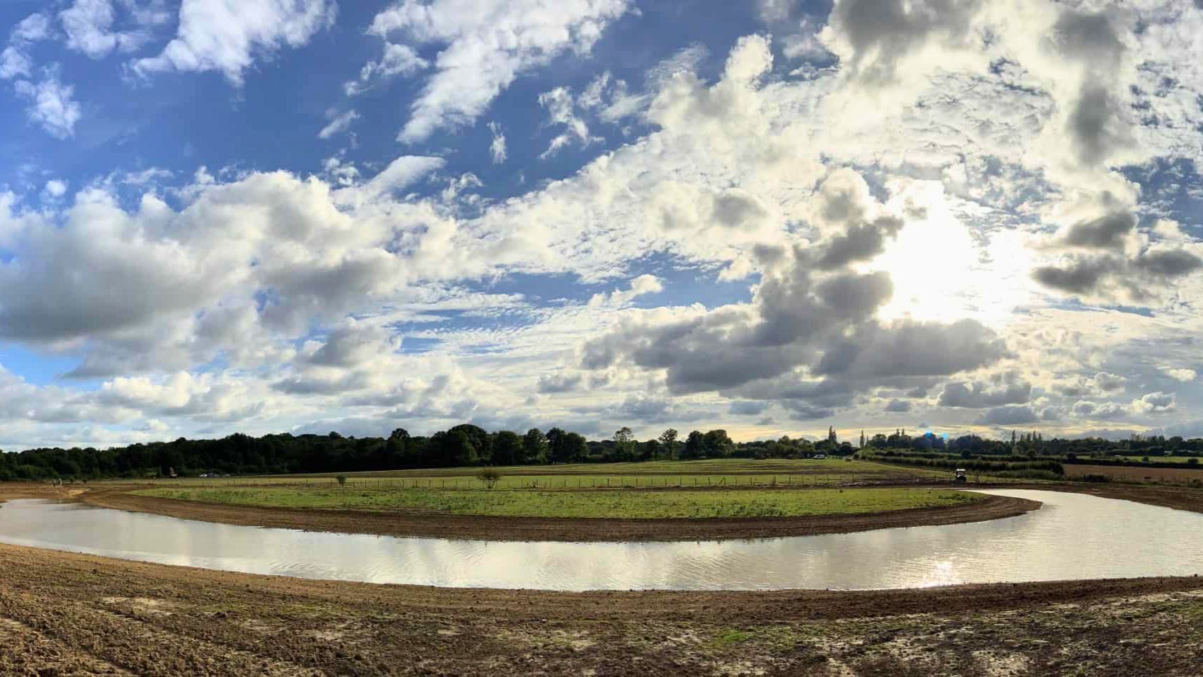
Sissinghurst Castle and Gardens
Working with the National Trust, we restored a floodplain water meadow by creating a scrape and installing a channel to direct high flows into the area during wet weather.
The project created 2.3 hectares of wetland habitat, benefiting species including little egret, teal, snipe and dragonflies while helping to reduce flood peaks in the Hammer Stream.
Bedgebury National Pinetum and Forest
In partnership with the Forestry Commission, we installed 60 leaky wood structures throughout Bedgebury Forest.
These interventions created around 1,500m³ of flood storage and helped form two hectares of wetland habitat along a 2km stretch of river. The new wetlands now support a wide range of plants, fungi and amphibians, including smooth newts and common frogs.
Sissinghurst natural flood storage © South East Rivers Trust
Alder Stream
The Alder Stream is particularly vulnerable to rapid flooding due to its clay soils and steep valleys.
To help reduce flood risk for downstream communities, we:
- Installed 90 leaky wood structures
- Fenced 11 hectares of ancient woodland to support habitat recovery
- Added hedgerows, scrapes and bunds through subsequent phases of work
Ongoing monitoring is helping us understand how these interventions perform and inform future Natural Flood Management projects.
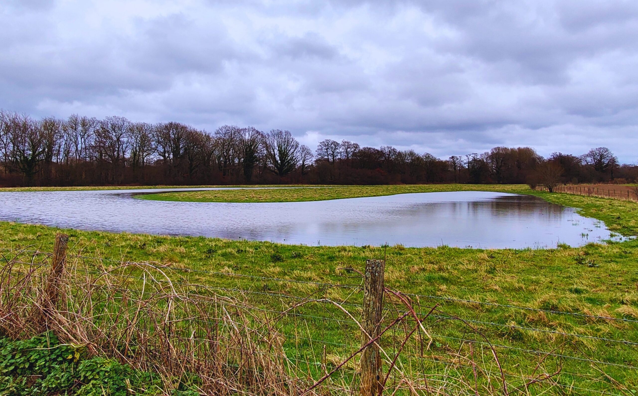
School Stream
The School Stream, a tributary of the River Beult, is another catchment prone to flash flooding.
To help protect nearby communities, we:
- Installed 25 leaky wood structures
- Created a pond providing approximately 600m³ of flood storage
The pond also improves water quality by trapping sediment and has quickly become a valuable habitat, with more than 20 plant species recorded within its first year.
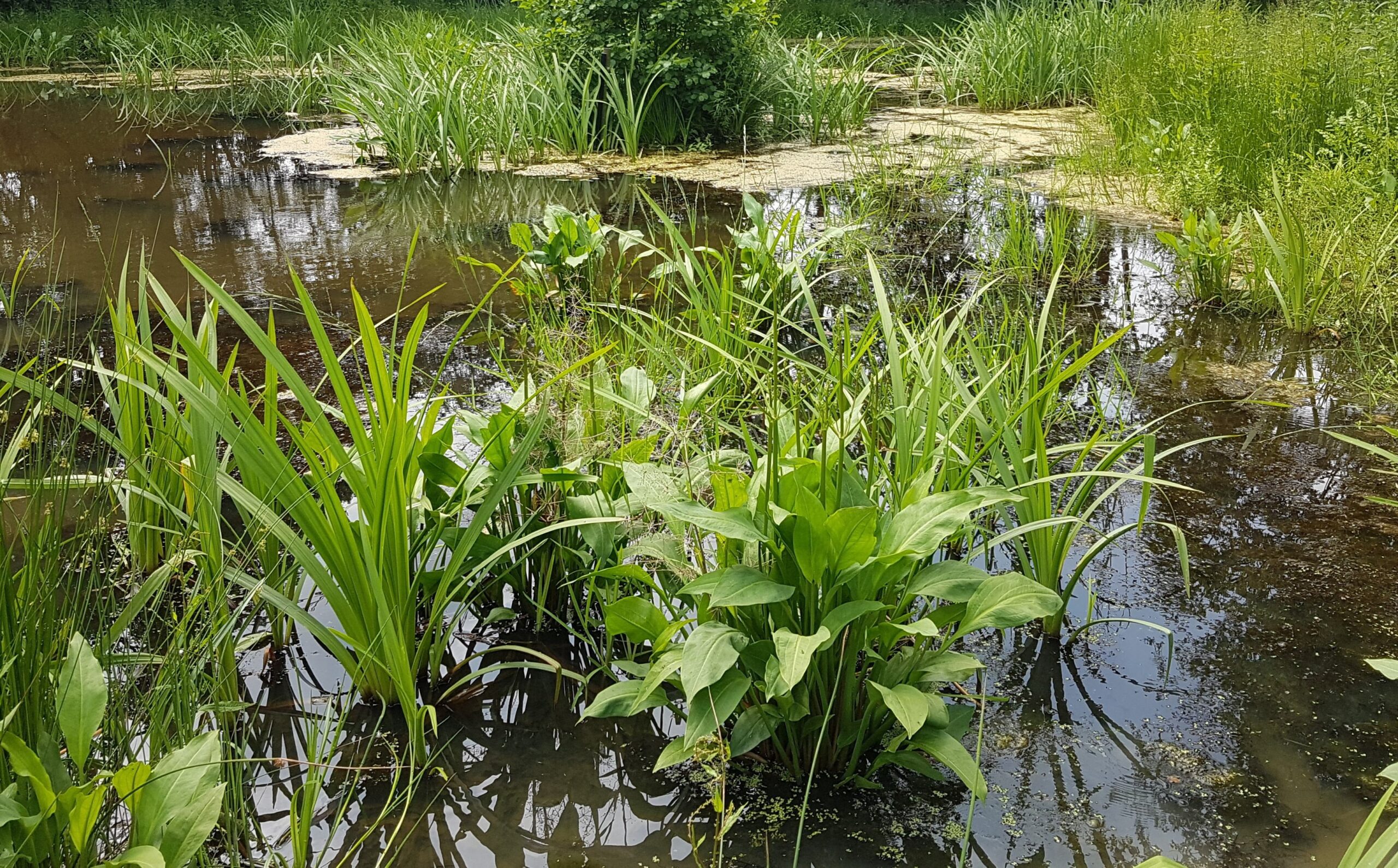
Flood storage pond in the School Stream headwaters © South East Rivers Trust
Monitoring and learning
Natural Flood Management is an evolving approach to flood risk management. We continue to monitor these sites using flow gauges, water level loggers and innovative technologies, alongside support from citizen scientists.
This evidence helps us understand how Natural Flood Management performs in different landscapes and ensures future projects deliver the greatest possible benefits for both people and nature.
Help build more resilient river catchments
Your support helps us work with landowners, communities and partners to deliver projects that reduce flood risk, improve water quality and create space for nature. Together, we can help rivers thrive.