Volunteers test pollution levels on River Mole

Volunteers test pollution levels on River Mole

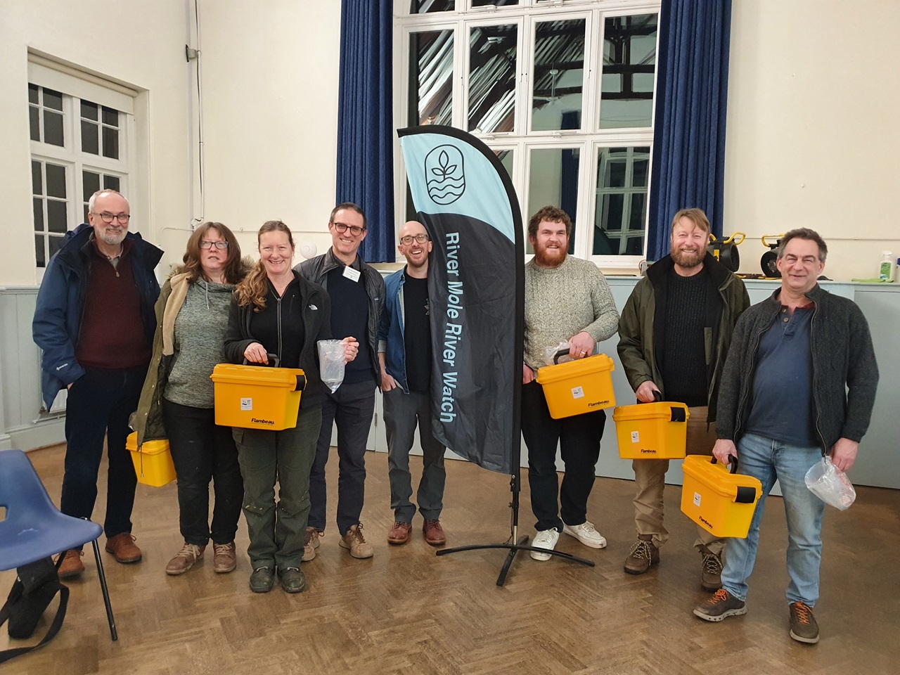
Volunteers are now collecting vital data about the health of the River Mole, after being given water quality testing kits as part of our Mending the Upper Mole project.

We are thrilled to have teamed up with River Mole River Watch, a local charity group which shares our aim to bring the river back to life for wildlife and people to enjoy.

Lewis briefs the volunteers on how to use the kits to test for pollution on the River Mole

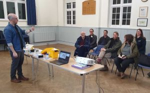
Having picked up their kits this week, the citizen scientists will now be carrying out monthly tests for the next two years, to give us a baseline of pollutants. The volunteers will be measuring 10 aspects of river health, including levels of phosphate, ammonia, nitrate, conductivity, pH for acidity and temperature. All of this data is crucial to help us understand how to improve the river.

Lewis Campbell, SERT’s Catchment Manager in charge of the Mending the Upper Mole project, said: “It is fantastic to have a group of volunteers who want to get into the nitty gritty of looking after their local river by carrying out water quality tests to assess pollution levels. We know River Mole River Watch play an active part in caring for their stretch of river and it is brilliant to team up with them as they do so.

“The volunteers will be helping the Mending the Upper Mole project to assess the health of this section of river in a way that has not been done before. The results will allow us to highlight hotspots of pollution, helping the catchment partnership to implement strategies to  combat pollution and help the catchment thrive. We have already added gravels to the river at Maidenbower to help fish and we are working on a number of other projects to improve the waterway for wildlife.”

Simon Collins, one of the Trustees of River Mole River Watch, said: “Our fantastic River Mole River Watch volunteers have been collecting water quality test data across the whole catchment every month for a year. Partnering with SERT has been very helpful indeed and we are excited by the Mending the Upper Mole project as it focusses on water quality and pollution in the Upper Mole which is a particularly sensitive part of the river catchment area. More data will help to identify hot spots and areas we can work with SERT to improve.”

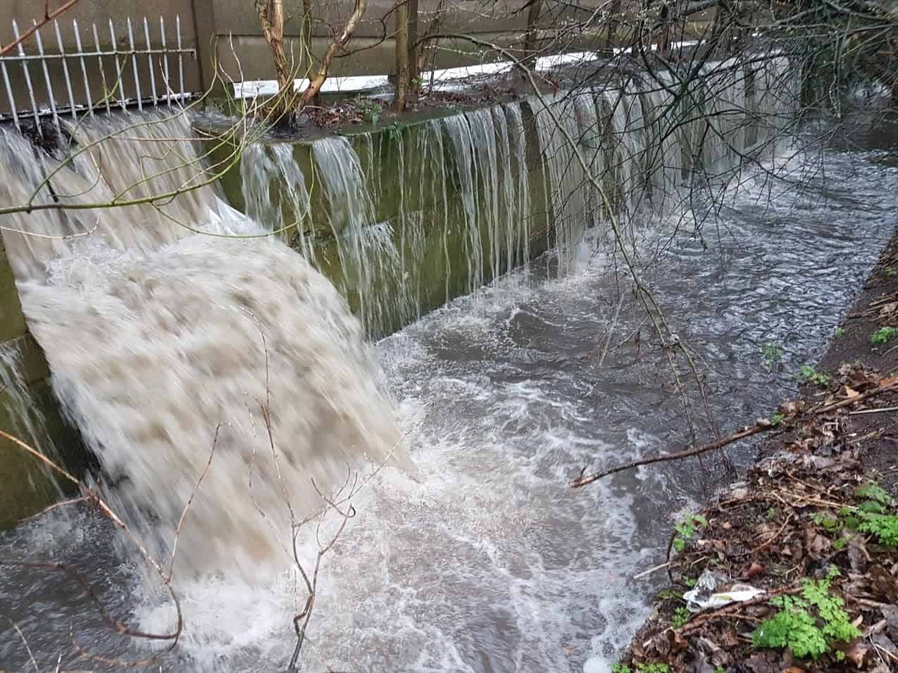
The River Mole catchment partnership is co-hosted between SERT and Surrey Wildlife Trust and the vision is set out on the river network’s Storymap website. The Water Framework Directive status for the water quality in the area being assessed is rated “poor”. The area being measured starts close to the source of the Stanford Brook and encompasses much of the Gatwick Stream.

So what are we measuring and why?

The water quality testing kits that will be used by volunteers

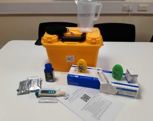
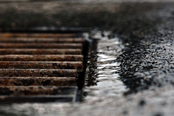
Self-contained testing kits will allow volunteers to monitor levels of chemicals such as phosphates and nitrates. High levels of both nutrients lead to algae growing in the water, depleting oxygen levels and obstructing light making the river unsuitable habitat for other wildlife. High phosphate readings would indicate pollution has likely occurred from untreated sewage – or domestic, misconnected plumbing that bypasses sewage treatment works and goes straight into rivers form surface water drains, known as outfalls.

Another chemical tested for will be ammonia, high levels of which would suggest pollution is coming from either sewage or agriculture. Conductivity measurements will also be taken to identify the presence of salts and heavy metals, indicators of road run-off washed into the river. A temperature reading will also be taken and higher readings are likely to be an indication of spillages from outfalls.


Volunteers with their kits
Volunteers from River Mole River Watch receive water quality testing kits to test for pollution

New online tool highlights nature-based solutions to tackle road runoff

A new online tool has been launched this week to help tackle road runoff pollution in London’s rivers by highlighting the best places to install nature-based solutions such as wetlands.

The development of the first-of-its-kind tool by Thames21 builds on years of research by the environmental charity and its partners Middlesex University and the South East Rivers Trust, which contributed with mapping, scoping and reporting.

Pollution from our roads adds to a number of problems for our rivers coming from sewer overflows, litter and misconnected drains. However it is often the Cinderella of pollution topics, because it receives far less public attention than sewage or agricultural causes.

Research from the Rivers Trust shows that the UK’s 1,600 rivers are affected by a cocktail of chemicals that are speeding up aquatic nature-loss, affecting insects, birds and mammals.

Road runoff goes straight to rivers

Road runoff can contain residue from oil spills, as well as tyre and brake wear from vehicles. These build up during dry weather and are then washed into rivers and streams when it rains.

The new tool will help decision makers prioritise the right water quality improvements:

  • in greenspaces that lie between the road and the river
  • at road locations in Outer London where surface water drains to the rivers; and
  • on London’s main strategic road network (includes Transport for London’s roads and some sections of National Highways’ and local authority roads)

Thames21 started its initial road runoff project identifying key polluting roads in 2019, with funding from the Mayor of London, Transport for London, and the Environment Agency. The British Geological Survey built the online decision support tool ‘Road Pollution Solutions’ and provided some additional support through the UKRI NERC-funded CAMELLIA project.

The South East Rivers Trust contributed research on sites in South London, including Surbiton, using its GIS mapping technology and catchment-based approach, identifying places where solutions such as wetlands could be built to counter the pollutants. By providing a natural barrier and filter using nature-based solutions, some of this road runoff pollution can be captured and prevented from entering rivers in the first place.

Users of the tool can search different boroughs, pinpoint particular areas and see just how polluting they are. This will help to prioritise where solutions could be put in place as mitigation. The tool shows the location of rivers, sewage outfalls and areas that drain into waterways.

Online road runoff tool example
An example of how the road runoff solutions user guide works

Modelling has shown that 2,415 road sections covering a total of 451.43km of London’s roads assessed pose a high risk of causing road runoff and are therefore a priority. Roads where heavy goods vehicles regularly apply their brakes are often the worst affected.

Community groups can also easily see pollution hotspots and help to suggest solutions by working for example with the authorities or through catchment partnerships.

The tool – which extends to all outer London boroughs – allows uses to access data by boroughs or river catchment and includes the Wandle, Beverley Brook, Hogsmill, Upper Darent, Lower Cray and Upper Cray.

Working in partnership, authorities responsible for these roads could intervene by providing nature-based solutions in these areas to help make runoff cleaner, and improve water quality in local rivers and watercourses.

Find out how the tool works by reading the user guide.

Have your say on sewage spills

The South East Rivers Trust is calling on its supporters to respond to the Government’s consultation on sewage spills – and ask for more urgency to tackle the issue.

The Government’s Storm Overflows Discharge Reduction Plan survey was launched on 31st March, with a deadline to respond by 12th May.

We’ve put together this short news piece to support you in understanding the issue and how your response to the consultation could help instigate the change we need.

First rain garden complete

The weather could not have been better for our planting day at Sutton Council’s Denmark Road Offices, writes Charlene Duncan. This planting day was organised to enable staff members to contribute to the new rain garden. Thanks to the hard work of everyone who came out, the rain garden is now complete!

Nearly 30 members of staff volunteered their time to transform the area in front of the building. It was a great chance for staff to meet people from other departments and to socialise with colleagues.  Staff members gave what time they could, from 20 minutes to more than three hours!  Every contribution was greatly appreciated.

This rain garden is part of our SuDS in Sutton’s Schools project.  It demonstrates sustainable drainage systems (SuDS) to the schools involved in the project and the wider community. SuDS are measures that divert water from the drains to reduce flood risk and improve the quality of water flowing into our rivers.

By waiting until the autumn to plant up the rain garden, we have increased the new plants’ chances of survival.  Planting during this summer’s drought would have meant the plants required a lot of watering.  While a bit of watering is still necessary for the newly planted garden, once established, the water from the offices’ downpipes will be all that is needed.

So, a massive thank you to all volunteers who gave up their time.  And, an extra thank you for those of you who could not give your time but offered moral support and encouragement on the day.  The garden is looking lovely and it’s all down to you.

Now all we need is some rain.

Watch our timelapse video of the rain garden being constructed