A new online tool has been launched this week to help tackle road runoff pollution in London’s rivers by highlighting the best places to install nature-based solutions such as wetlands.
The development of the first-of-its-kind tool by Thames21 builds on years of research by the environmental charity and its partners Middlesex University and the South East Rivers Trust, which contributed with mapping, scoping and reporting.
Pollution from our roads adds to a number of problems for our rivers coming from sewer overflows, litter and misconnected drains. However it is often the Cinderella of pollution topics, because it receives far less public attention than sewage or agricultural causes.
Research from the Rivers Trust shows that the UK’s 1,600 rivers are affected by a cocktail of chemicals that are speeding up aquatic nature-loss, affecting insects, birds and mammals.
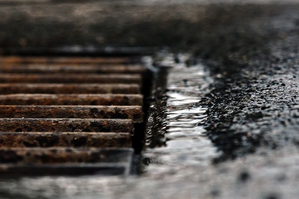
Road runoff goes straight to rivers
Road runoff can contain residue from oil spills, as well as tyre and brake wear from vehicles. These build up during dry weather and are then washed into rivers and streams when it rains.
The new tool will help decision makers prioritise the right water quality improvements:
in greenspaces that lie between the road and the river
at road locations in Outer London where surface water drains to the rivers; and
on London’s main strategic road network (includes Transport for London’s roads and some sections of National Highways’ and local authority roads)
Thames21 started its initial road runoff project identifying key polluting roads in 2019, with funding from the Mayor of London, Transport for London, and the Environment Agency. The British Geological Survey built the online decision support tool ‘Road Pollution Solutions’ and provided some additional support through the UKRI NERC-funded CAMELLIA project.
The South East Rivers Trust contributed research on sites in South London, including Surbiton, using its GIS mapping technology and catchment-based approach, identifying places where solutions such as wetlands could be built to counter the pollutants. By providing a natural barrier and filter using nature-based solutions, some of this road runoff pollution can be captured and prevented from entering rivers in the first place.
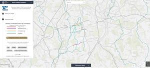
Users of the tool can search different boroughs, pinpoint particular areas and see just how polluting they are. This will help to prioritise where solutions could be put in place as mitigation. The tool shows the location of rivers, sewage outfalls and areas that drain into waterways.
An example of how the road runoff solutions user guide works
Modelling has shown that 2,415 road sections covering a total of 451.43km of London’s roads assessed pose a high risk of causing road runoff and are therefore a priority. Roads where heavy goods vehicles regularly apply their brakes are often the worst affected.
Community groups can also easily see pollution hotspots and help to suggest solutions by working for example with the authorities or through catchment partnerships.
The tool – which extends to all outer London boroughs – allows uses to access data by boroughs or river catchment and includes the Wandle, Beverley Brook, Hogsmill, Upper Darent, Lower Cray and Upper Cray.
Working in partnership, authorities responsible for these roads could intervene by providing nature-based solutions in these areas to help make runoff cleaner, and improve water quality in local rivers and watercourses.
Find out how the tool works by reading the user guide.
The health of the UK’s rivers is increasingly at the forefront of the public consciousness. It is therefore vital that organisations working to protect and restore our rivers communicate openly and effectively with the public through innovative channels. It is also vital that all organisations working on a river network combine their efforts in a collective approach. What happens upstream affects the downstream.
We are delighted to launch the latest in our series of catchment ArcGIS Storymaps, on behalf of the wider River Mole catchment partnership. This partnership brings together about 45 organisations and individuals who are committed to protecting and enhancing the health of the watercourses across the entire river network. The South East Rivers Trust (SERT) co-hosts the partnership with the Surrey Wildlife Trust.
Through the River Mole Storymap anyone interested in the multiple threats to the river’s health, and the activities of the Catchment Partnership which aim to mitigate those threats, will be able to access detailed information, beautifully mapped for context and understanding.
Below, Dr Lewis Campbell, the Catchment Manager, provides a brief introduction to the Mole catchment, and highlights the work some of the organisations involved in its care and restoration.
Clay and chalk bring different issues
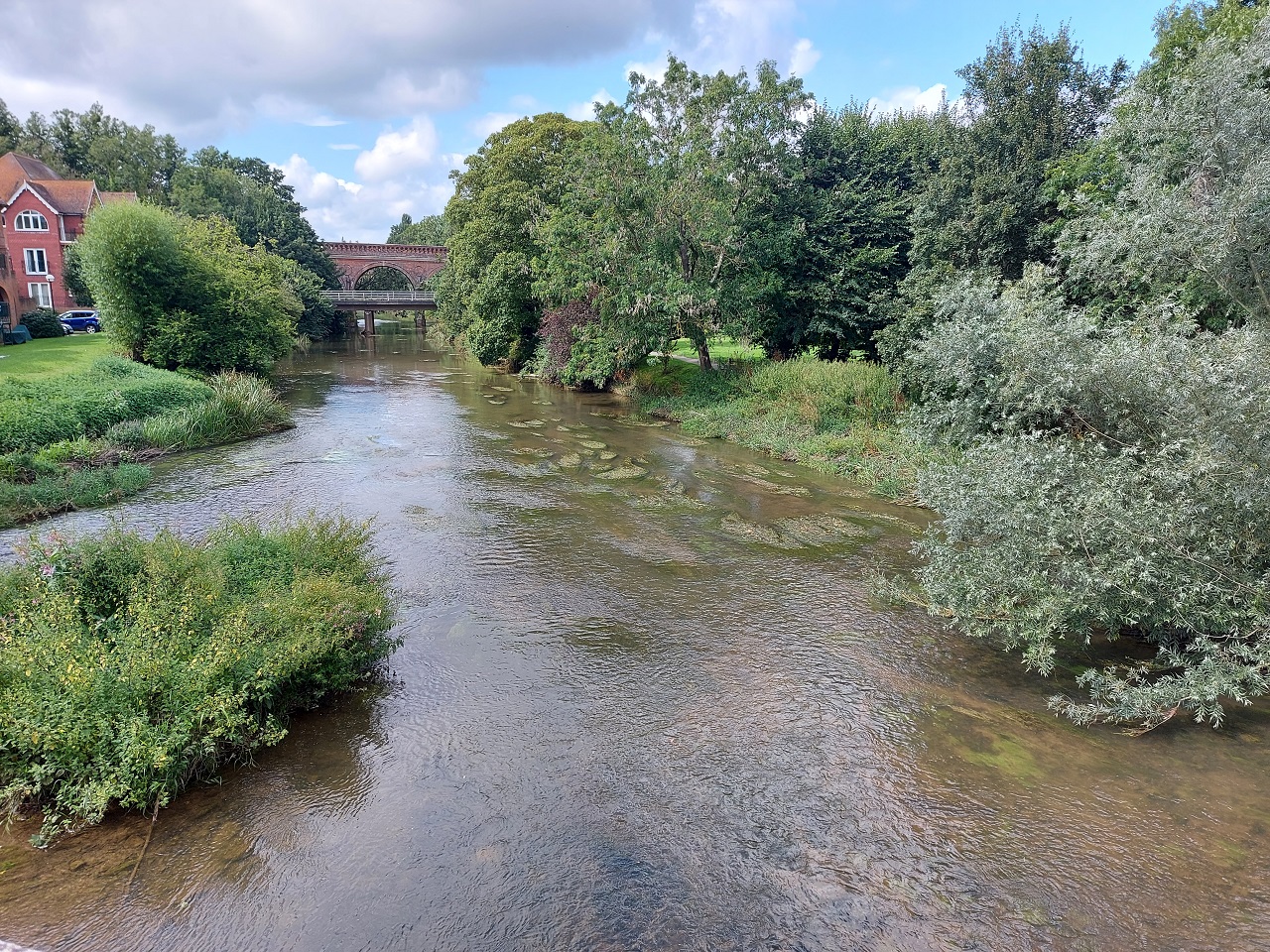
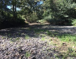
The River Mole at Leatherhead
The catchment of the River Mole covers an area of just over 500km², spread across Surrey and West Sussex. The catchment is largely rural pasture and farmland, but is home to some significant urban areas including Crawley, Reigate, Dorking, and Leatherhead.
The catchment’s main watercourse, the River Mole, rises to the west of the town of Crawley, before flowing for 80km until it joins the River Thames opposite Hampton Court Palace.
Differences in the natural characteristics of the catchment in its upper and lower reaches provide a division into two sub-catchments. The area from the town of Leatherhead down to the confluence with the Thames forms the Lower Mole and Rythe sub-catchment, whereas the area above Leatherhead forms the Upper Mole sub-catchment.
Across its watercourse, the River Mole is joined by numerous tributaries, including the Gatwick Stream, Tilgate Brook, and Baldhorns Brook, to name a few. Although the river largely flows over clay, it carves out spectacular cliffs in the chalk bedrock in the area between Leatherhead and Dorking, also known as the Mole gap.
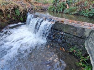
Challenges include pollution, weirs, flood and drought
A weir at Tilgate is one of many barriers to fish passing along the river
The water bodies that make up the Mole catchment vary in their Water Framework Directive (WFD) classification status from Moderate to Poor, and this reflects the numerous and varied challenges facing the catchment.
The major issue impacting the catchment at large is pollution from waste water sources. The catchment is home to several relatively large towns, so there are a number of sewage treatment facilities present which discharge treated effluent directly into the river, and occasionally also untreated sewage in times of higher than usual rainfall.
The Storymap allows residents to see Thames Water’s live sewage release data. These discharges carry with them excessive nutrients, such as phosphates and nitrates and micro-organisms, which can have a negative impact on the quality of the habitat available for aquatic life such as fish and plants.
The catchment runs primarily over clay. Couple this with the relatively large urban areas and the presence of the UK’s second largest airport (Gatwick) and rain that falls on the catchment very quickly makes its way into the water course, directly from hard surfaces such as roads and runways, or from fields.
This run-off carries with it numerous chemicals and other pollutants which can also degrade the quality of the river habitats available for wildlife. In rural areas, run-off will also carry significant amounts of soil and sediments from fields which can clog up the valuable gravel areas in which aquatic invertebrates like to reside, reducing the food availability for larger organisms such as fish.
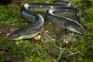
Another issue is that fish are also negatively affected by the numerous barriers within the catchment. These barriers are often types of weir – solid structures placed into rivers to alter their level and flow. These physically stop fish from navigating the full extent of the water course. This prevents them from accessing the variety of habitat types that they require to thrive, something particularly harmful to those species such as salmonids and the critically endangered European eel which have complex life cycles that involve migration to and from the ocean.
Parts of the River Mole are prone to low flows
Interestingly, the catchment is prone to both flooding and problematic low flows. Many of the catchment’s waterways have been historically altered to make them more navigable, or to make way for development. This often involves straightening and re-enforcing the river channels, which disconnects the river from their adjacent flood plain.
Disconnection from the flood plain means that during periods of heavy rainfall the water which quickly runs over the catchments clay and concrete into the rivers has no way of escaping the channels, resulting in excessively high water levels and flooding. Conversely, in times of low rainfall, connected flood plains can retain water which slowly makes its way into the watercourses, maintaining flow. A lack of connected floodplains in the catchment means that the Mole and its tributaries often experience low flows during the height of summer, again negatively impacting aquatic life.
Water quality work under way
As the climate becomes more unpredictable it is likely that these issues will occur more frequently or with increased severity. Fortunately, there are steps that we can take to try to avoid this situation, or help the catchment cope.
Partnership members work either individually or together on projects to improve the catchment, but meet on a regular basis to share expertise and experience. The idea is that by working together, groups can pull their knowledge and resources together and agree actions that are right for the whole river (a holistic approach) rather than act in isolation on small sections.
One of the partners, the River Mole River Watch, which is spearheading catchment wide water quality monitoring efforts through their network of volunteers. This initiative will allow the partnership to identify locations which are being particularly impacted by pollution and poor water quality. Armed with this knowledge, catchment partners will then be able to design and implement measures to prevent pollution, or reduce its impact.
Learn more about our eels project and Crawley focus
European eel image Photo by Darryl Clifton-Day
SERT also works with communities and landowners to identify ways to reduce run-off pollution in urban and rural environments, such as changes in land management practices.
Where reduction of pollution is not possible, SERT is involved in projects to improve river habitat, create backwater refuges and remove barriers so that fish and other aquatic organisms can move into less polluted areas. SERT is also leading on projects to reconnect the waterways of the Mole catchment with their flood plains, providing natural flood management and low flow resilience.
Our work at SERT on the Mole already, among many listed on the Storymap, has included a project to promote and help the critically endangered European eel. During the Thames Catchment Community Eels project – part of wider work on several rivers across the south east – we found twice the number of barriers to eel migration, such as weirs, as had been recorded previously. We also ran workshops and assemblies for 1,136 children and put on other public education sessions, to highlight how this species of fish needs to be able to reach the ocean to complete its life cycle.
We are currently working up our Caring for Crawley’s Rivers project, which will combine river restoration with community engagement such as education in schools and with other groups.
With our newly launched catchment Storymap, you can take a deeper dive into River Mole catchment and the actions that our catchment partners are taking to protect it. You can also find information on opportunities for you to get involved.
Visit our River Mole Storymap, find out about the work to protect and enhance the river and how to get involved!
The South East Rivers Trust has been tackling pollution in rivers ever since it was formed – as the Wandle Trust – 20 years ago.
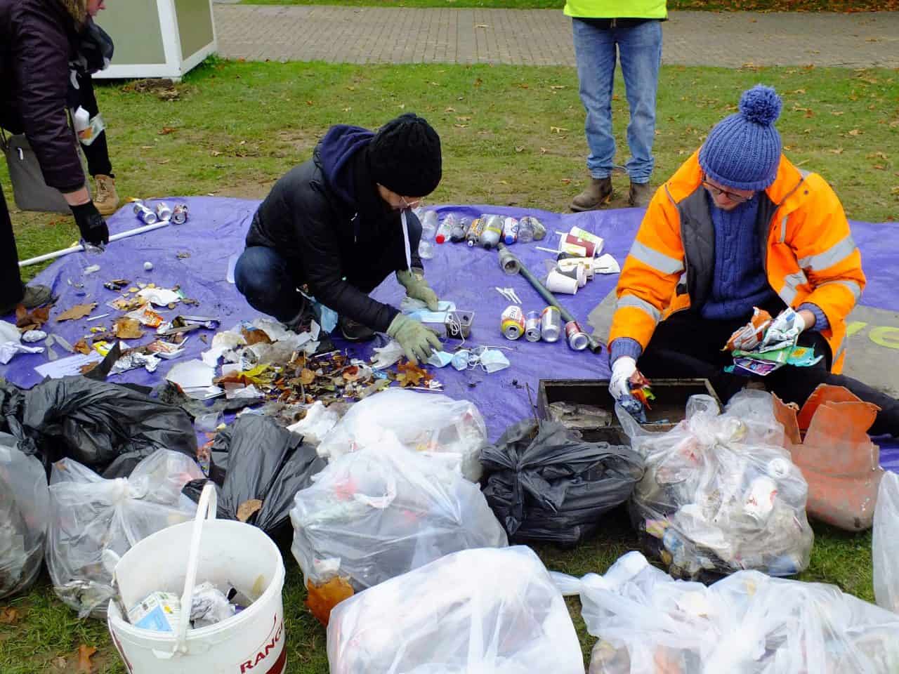
Becoming involved with the Preventing Plastic Pollution project, on the River Medway, seemed a natural step. Plastic pollution affects all rivers, however. Therefore we want to develop our work beyond one area by engaging with a wider public as well as including the issue in our catchment action plans.
A year’s worth of cleanups give us the perfect evidence to shape behaviour change across our whole area – and the annual Plastic Free July campaign presents an appropriate moment to raise awareness of the issues and strive to change our habits. Set up in 2011, the annual campaign aims to help people reduce their reliance on single-use plastic and live by more sustainable methods. Below, we’ve come up with several suggestions for you to try in July – and hopefully continue with well after one month.
We use cookies to ensure that we give you the best experience on our website. If you continue to use this site we will assume that you are happy with it.OkNoPrivacy policy