The South East Rivers Trust (SERT) recently completed a chemical pollution survey across three local rivers to understand what harmful substances are polluting our waterways. The project, funded by the Environment Agency (EA) and carried out in partnership with Imperial College London, used special devices called passive chemical samplers to detect various chemicals in the water.
Where did we test?
We focused on three tributaries in our river catchments:
At each tributary, we placed the sampling devices at five different locations along its course. The devices were positioned to capture data from both urban and rural areas. These devices stayed in the water for two weeks before being retrieved and sent to a lab for analysis.
What did we find?
We tested for the presence of 35 different chemicals, including antibiotics, prescription medications, recreational drugs, pesticides, and herbicides. Shockingly, we found about 62% of the 35 chemicals we tested for in all three rivers. Some of the most concerning chemicals detected include:
Clarithromycin (an antibiotic)
Imidacloprid (a neonicotinoid pesticide)
Fipronil (used in flea and tick treatments)
Why does this matter?
The presence of these chemicals in our rivers is a serious issue. Antibiotics in the water can lead to the spread of antibiotic-resistant bacteria, which is a growing public health concern. Pesticides like neonicotinoids are particularly harmful to aquatic invertebrates such as dragonflies, snails and shrimps, which are crucial to the health of the entire river ecosystem.
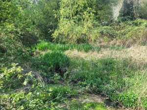
The River Blackwater in the River Loddon Catchment.
What can be done?
To tackle this pollution, we need upgraded sewage treatment systems and improved agricultural land management practices. However, there are also nature-based solutions that can help, such as creating new wetlands. The South East Rivers Trust recently delivered a nature-based solution with the Chamber Mead wetland project. This project cleans 250 million litres of water through natural systems, effectively combating pollution. Wetlands play a crucial role in keeping our water clean by filtering out sediments, chemicals, and other pollutants. They also help remove excess nutrients that often come from farms and construction sites, locking up pollutants in their sediments, soils and vegetation.
How you can help
Protecting our rivers requires everyone’s effort. By supporting initiatives like our Chamber Mead wetlands, volunteering at local events and donating to help fund vital restoration projects, we can all contribute to cleaner, healthier rivers. Find out more about how you can help your local river: https://www.southeastriverstrust.org/take-action/
We recently welcomed the Secretary of State for Environment, Food and Rural Affairs Steve Reed MP, the Chairman of the Environment Agency Alan Lovell, and DEFRA Director of Water Sebastian Catovsky to our Chamber Mead wetlands. During their visit, the South East Rivers Trust team highlighted the multiple benefits of working with nature to tackle river pollution and other environmental issues.
Promoting Nature-Based Solutions
During the visit, we explained how nature-based solutions significantly reduce river pollution. Moreover, we found the new Government’s interest in these innovative approaches encouraging. To help our rivers recover more widely, we emphasised the need for the Government’s support to rapidly scale up these projects.
Dr. Bella Davies, CEO South East Rivers Trust, said:“We are delighted to host the Secretary of State at the Chamber Mead wetland today. The wetland tackles sewage and urban road runoff pollution before it enters the Hogsmill River, which is a rare chalk stream, one of around 220 in the world, supporting a unique set of species dependent on the chalk-purified water. We are glad that the new Government sees the wide benefits of nature-based solutions and we urge them to take action to break down barriers to these kinds of projects and support organisations such as ours to deliver more at scale in the future.”
Governments Commitment to Water Quality
We’re pleased to hear that the new Government acknowledge the importance of improving water quality, which was highlighted in the King’s Speech, with plans for water industry reform. However, we emphasised the need for ambitious action on agricultural pollution, road run-off, and over-abstraction. We delivered this message directly to Steve Reed MP during his visit.
Exploring Chamber Mead Wetland
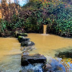
Steve Reed MP toured the Chamber Mead wetland with Rivers Trust CEO Mark Lloyd and SERT CEO Dr. Bella Davies. Alan Lovell, Chair of the Environment Agency, and Sebastian Catovsky, DEFRA Director of Floods and Water, also joined the visit. Chamber Mead demonstrates how nature-based solutions can vastly improve our waterways and combat river pollution. We have redirected the water from the Green Lanes Stream through a sediment trap and two wetlands instead of letting it run straight into the Hogsmill River. At the other end, we connected the wetland to the Hogsmill River downstream of the stepping stones. As they develop, the wetlands will provide diverse habitats and amenities to the Hogsmill Local Nature Reserve and improve water quality for a 200-metre section of this rare chalk stream.
The Chamber Mead wetlands help conserve the Hogsmill River, a rare chalk stream. This project cleans 250 million litres of water through natural systems, effectively combating pollution. The wetlands are part of a broader partnership between the Rivers Trust and The Coca-Cola Foundation.
Looking Ahead
The visit underscored the importance of these projects and the need for continued support. With the backing of the Government and our partners, we can achieve significant progress in restoring and protecting our rivers.
For more information on our projects and how you can get involved, visit the South East Rivers Trust website. Join us in making a difference for rivers across the South East.
The school summer holidays are here and its is time to proudly reflect on another fantastic year for Project Kingfisher. Come rain or shine, our dedicated Education Team have been busy connecting over 5000 school children with nature. Highlights of the year saw students helping to plant our new wetland, Chamber Meads, creating lasting memories through hands-on experience, and our Education Officer winning the Peter Spillett Award.
Educational Experiences with Project Kingfisher
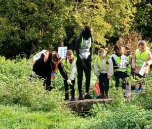
Project Kingfisher offers a wealth of educational experiences, including assemblies, interactive walks, and river dipping sessions for school children and youth groups. The sessions span the Beverley Brook, Wandle, Hogsmill, and River Mole, ensuring accessibility for many schools in the South East. We offer activities and opportunities to support teaching and to help inspire pupils’ love of nature through learning.
Connecting Young People to Nature
At the heart of our sessions is the aim to connect young people to their local environment and its wildlife. Through activities like creating natural art, listening to birds, and making promises to support the river, we inspire students to appreciate and care for their surroundings. Additionally, we link our sessions to the National Curriculum therefore reinforcing classroom learning and hands-on experiences that make the natural world come alive.
Positive Feedback from Teachers and Students
We received 100% positive feedback on our sessions with one school creating a podcast about their experience which highlights the inspirational impact of Project Kingfisher. Here are some of the wonderful comments we’ve received from teachers:
“Project Kingfisher is perfect for introducing children to our rivers. The delivery and content engaged the children, and they had an absolute blast!”
“The assembly entertained and engaged children from Years 1-5 equally. It was visual, full of information, and involved children in activities throughout.”
“Our second time river dipping, and the classes loved it both times. The project is well-organised, links neatly to the curriculum, is superbly resourced, and knowledgeably run. As a teacher, this is exactly what we look for on an afternoon trip. It offers fun and exploration in the outdoors that isn’t often experienced by children these days. Great fun for all, even the accompanying parent helpers.”
“The river assembly and the interactive walk linked beautifully with pupils’ learning at school. They enjoyed being guided by an expert, which helped them think about the importance and sustainability of the river.”
“I loved listening to the different sounds of birds and nature.”
“I loved making a promise to make sure that the tributary will keep flowing and not dry up!”
Book Your Session for September
As we gear up for the new school term, we encourage you to book your sessions with Project Kingfisher. Give your students the opportunity to discover the wonders of their local rivers and develop a lasting connection with nature.
For more information about our education sessions, visit our Project Kingfisher Education Page or email us at education@southeastriverstrust.org. Schools in Crawley can also join us for special sessions at Gratton’s Park on the Gatwick Stream through our “Our River Our Water” programme.
A fun-filled family day in Elmbridge Meadows is the centre-piece of the South East Rivers Trust’s contribution to London Rivers Week 2024.
Residents have the chance to learn about our project to improve the river at Elmbridge Meadows
Residents will have the chance to learn how our Enriching Elmbridge Meadows project, starting later this year, will improve the River Hogsmill in this local nature reserve in Berrylands, Kingston.
The community will have the chance to learn how to remove Himalayan Balsam first hand, via a “balsam bash”, alongside other activities such as guided walks and crafts.
The event takes place on Sunday 23rd June, on the first weekend of London Rivers Week (22nd to 30th June), as groups across the capital invite people to celebrate the theme of ‘London is a River City’.
Emma Broadbent, SERT’s Volunteer and Engagement Officer, said: “We are always thrilled when London Rivers Week comes around because south London’s rivers are where our work began.
“Our range of events give people the chance to learn why the Hogsmill, Beverley Brook and Wandle rivers are vital to communities and wildlife, and what they can do to help protect and enhance them.
“In particular, London Rivers Week 2024 gives the communities of Surbiton, Tolworth and Kingston the perfect opportunity to find out how our Enriching Elmbridge Meadows project will re-naturalise 1km of the River Hogsmill. Our information stall and guided walks will give more information on the river and the project, children can enjoy our craft activities and people of all ages can delight in seeing what actually lives in the river at our river dipping table.
“We will have lots of volunteering opportunities as part of this project, with a focus on managing Himalayan Balsam. This non-native invasive species destabilises river banks, spreads very easily and outgrows native plants.”
Further restoration plans for Elmbridge include adding gravel to the river to give fish and invertebrates refuge places and areas to spawn, and adding woody debris to re-wiggle a straight and narrowed river so that nature can thrive better.
A SERT volunteer tackles Himalayan Balsam
As well as the Elmbridge Meadows day focusing on the Hogsmill (10am to 3pm), SERT will also be staging three other events during the week, giving people the opportunity to understand the importance of rivers and take action to protect them.
Sign up for:
A balsam bash at Six Acre Meadows, to protect the River Hogsmill from this non-native invasive species, on Tuesday 25th June, 10am to 2pm.
A guided walk from Richmond Park to Wimbledon Common (and back!) to learn about the history, ecology and restoration work along on the Beverley Brook on Wednesday 26th June, 10am to 12.30pm.
A River Wandle cleanup at Poulter Park, Carshalton, clearing rubbish from the river to protect wildlife and help it thrive, on Thursday 27th June 10am to 2pm.
The eighth annual London Rivers Week, organised for the River Partnerships in London, features about 60 events. These range from river clean-ups to cultural experiences, emphasising the intrinsic links between people and their waterways, all designed to raise awareness of the capital’s network of rivers, how they benefit us and how we can protect them.
London Rivers Week is organised for the River Partnerships in London (RiPL) via the London Rivers Week steer group. The principal organisations running London Rivers Week are the Environment Agency, Thames21, the South East Rivers Trust, London Wildlife Trust, ZSL, CPRE London, and the Thames Estuary Partnership. In addition to these organisations, many other groups run and contribute to events, walks, talks and seminars to demonstrate the value of rivers.
We are delighted to have teamed up with GLi, the logistics warehouse company, which has produced a short film documenting Project Kingfisher, our flagship education programme which deepens the younger generation’s experience of urban waterways.
As part of the company’s dedicated social value programme, Urban Life, GLi has joined forces with Project Kingfisher to champion river sessions in Merton, close to its forthcoming Mitcham site, that offer children an immersive, hands-on experience with the river.
GLi’s Urban Life programme has supported our Project Kingfisher education programme
The film aims to share the experience of local children who, through these sessions, are encouraged to explore not only the riverbank’s visible features but also the world thriving beneath the water’s surface. Through these river dipping and outdoor learning activities, primary school pupils and youth groups get close to diverse river inhabitants, while having the opportunity to explore their local area.
Polly Penn, Head of Working with Communities at the South East Rivers Trust, said: “We are delighted that GLi has decided to support our education programme. Support by businesses such as GLi is vital in helping us to inspire children by connecting them to rivers.
“Our aim is that every primary school child should experience the fun of outdoor learning. This helps young people not only learn the importance of protecting water but also helps them develop fantastic personal skills. Studies show that children who learn outdoors develop confidence in diplomacy, negotiation and social skills which in turn will help them prepare as adults for the challenges we face from climate change. We are delighted that GLi wishes to share in our vision.”
Children learning at an outdoor Project Kingfisher session
London’s rivers, once a vital part of the city’s industrial heritage, now serve as vital sanctuaries for urban biodiversity and community well-being. Recognising their pivotal role, GLi’s Urban Life programme advocates for the preservation and revitalisation of these historic waterways. Its commitment extends to supporting initiatives that improve access for the community, enhancing water ecology and supporting canal and river heritage education – enriching the lives of those around our industrial units.
The company is pleased to support Project Kingfisher’s work in Merton, ahead of their Mitcham Park development in the area, set to begin later this year.
The South East Rivers Trust runs Project Kingfisher education sessions designed for Key Stage 1 and 2 pupils across the Beverley Brook, Hogsmill and Wandle rivers, outdoors and indoors. For details of all our sessions, along these and other river catchments, visit our education page where you will find details of how to book.
We’re calling on you to join the #VoteforRivers campaign run by the Rivers Trust in the lead-up to the General Election on Thursday 4th July.
This is your chance to use the power we have as voters to advocate for nature restoration and to take this vital opportunity to speak up for healthy rivers.
We’ve set out asks under five headings, whether you plan to seek answers from candidates who come knocking on the door, question them at local hustings or want to write to them.
You can find the candidates running in your area using The Electoral Commissionand download the letter to write to them, or have the asks handy when meeting candidates in person.
We want you to ask the new Government to:
1. Prioritise nature recovery – make nature-based solutions like trees and wetlands to improve the environment and tackle climate change as first choice, rather than relying on chemicals and concrete.
For example, we at the South East Rivers Trust have just completed Chamber Mead wetlands in Ewell, Surrey, which diverts road runoff away from the River Hogsmill. Plants being established there will also bring huge biodiversity benefits to the Hogsmill Local Nature Reserve.
We are working on restoring water voles, eels and trout via our WET Hogsmill project, we have restored a section of the River Blackwater in Hampshire and the Wandle in Morden Hall Park with woody debris and by adding gravel.
2. Improve our understanding of rivers – support better data and evidence to improve regulatory monitoring and recognise the value of citizen science alongside it.
Through our work engaging the public and encouraging them to take part in citizen science, we collect data on the health of our rivers. Examples include training volunteers to:
Discover how much misconnected plumbing is in our rivers through our Outfall Safari work
Carry out riverfly monitoring to judge the health of rivers and whether there has been pollution, by finding invertebrates
3. Support education and engagement about rivers – No one will protect what they don’t know about or understand – and what they have not experienced. So we need the Government to support education about the environment and rivers at all levels.
The South East Rivers Trust has an extensive education programme
The South East Rivers Trust has programmes supporting education of primary school children and community groups across London catchments and the River Mole.
Our events also demonstrate the value of our work through walks and talks across a wide range of topics and we take part in awareness campaigns such as London Rivers Week.
4. Make polluters pay – drive strong enforcement of those who pollute to turn the tide on the abuse of our rivers.
We have recently supported a campaign to clear Hoad’s Wood in Ashford of fly-tipping. After a petition, the Government has now issued a clean-up edict which will cost the taxpayer huge sums. Nobody has yet been traced to pay for the clean-up.
5. Manage land with water in mind – empower collaborative working that gets everyone involved in restoring our rivers.
Leaky wooden dams are a nature-based solution used by SERT on the River Beult among other places
At the South East Rivers Trust we lead several catchment partnerships across 12 river catchments. These work collaboratively with many other organisations and individuals to bring rivers back to life. They need investment and funding to do so.
Our Holistic Water for Horticulture project also works with food growers in Kent and the South East to ensure water efficiency and resilience in the process of getting food from farm to fork.
This is part of the work of our Water and Land Stewardship team, which has worked closely with farmers on the River Beult in Kent on nature-based solutions to retain water and enhance biodiversity, for the benefit of wildlife and people. We are involved in national pilots for Environmental Land Management Schemes, funded by Government, working with farms to manage land in sustainable ways.
For example, we are working with farmers and landowners and other environment NGOs on the River Darent catchment to implement a radical, large-scale approach to delivering climate benefits – starting with rivers.
Here are some questions you can ask your candidates
How will you and your party tackle all types of pollution in our rivers? Sewage is not the only issue; farming and road runoff pollution are also devastating our rivers.
Will your party boost funding for regulators and strengthen enforcement so polluters are made to pay for their pollution?
How will your party work with nature to improve river health and tackle climate change?
How will your party open up rivers and blue spaces in our towns and cities for health and wellbeing?
How will your party support farmers and businesses manage their land sustainably for water?
No matter where you live across our 12 catchments, there is a river near you. Find our river using our map, using your postcode. There a hundreds of candidates standing for constituencies from Berkshire through Hampshire, Surrey, Sussex, Kent and south London who want your vote – so press them on the hot topics!
If you are writing to your candidates, you could use or adapt the Rivers Trust’s template, by copying and pasting the information below or adding in your own asks on rivers. Don’t forget you can source candidate details via The Electoral Commission.
Dear [Candidate name],
I will be voting for rivers in the General Election on 4th July 2024 and, as a local resident and voter, need to know how you intend to stand up for our waterways.
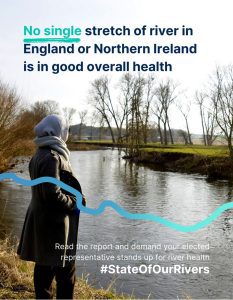
The Rivers Trust’s State of Our Rivers Report 2024 lays bare the dire health of our waterways, which are facing devastating levels of pollution, swinging between extremes of flood and drought, and experiencing shocking drops in biodiversity:
0% of stretches of river in England are in good or high overall health.
This is not breaking news – the issues faced by our rivers have been hitting the headlines for years and causing widespread public outcry. Yet not enough is being done to restore or protect our waterways.
Healthy rivers should be a priority for the next Government. From re-wiggling rivers, restoring floodplains, and greening our urban spaces, restoring our rivers means securing community resilience, a future for wildlife, and action for climate.
This is why I am supporting The Rivers Trust’s asks for political candidates and parties:
Prioritise nature recovery – make nature-based solutions like trees and wetlands to improve the environment and tackle climate change first choice, rather than relying on chemicals and concrete.
Improve our understanding of rivers – support better data and evidence to improve regulatory monitoring and recognise the value of citizen science alongside it.
Support education about rivers – no one will understand or care about what they haven’t experienced. Outdoor learning is key to nurturing a lifelong love of rivers.
Make polluters pay – drive strong enforcement of those who pollute to turn the tide on the abuse of our rivers.
Manage land with water in mind – empower collaborative working that gets everyone involved in restoring our rivers.
Please let me know what actions you and your party intend to take to deliver the asks above and restore the health of our waterways.
I look forward to hearing from you and, if possible, please copy info@theriverstrust.org in your reply.
Brown trout were able to return to the River Wandle and breed successfully for the first time in nearly 100 years thanks to the South East Rivers Trust’s work, Co-CEO Dr Bella Davies told the UK River Summit on Tuesday. Ian Lamont, our Communications Officer, reports.
An enthralled 100-strong audience at the second annual Summit heard that road runoff had been stopping trout spawning on the Wandle. The summit brought together campaigners, NGOs, politicians and industry experts to debate issues affecting rivers, in the historic setting of the National Trust’s Morden Hall.
Dr Bella Davies talks at the UK River Summit about preventing road runoff
Bella explained that a mechanical device called a hydrodynamic vortex chamber – effectively a big drum – had proven to be the solution to help brown trout thrive once more. It had been fitted to key parts of the river to filter out numerous chemicals and pollutants before they reached the Wandle.
Bella urged a captivated audience at the Summit to “implore policy makers to listen, investigate and do something about,” road runoff because the “solutions are there” to stop contaminants from roads reaching our rivers. She outlined the struggles to bring back brown trout, an iconic species, to the special habitat of this chalk stream, one of only about 220 such rivers globally.
The trouble trout had in the Wandle
A “top predator” and “keystone species” in the eco-system, brown trout had struggled to thrive in the Wandle because of pollution, with the last one caught there in 1934. The industrial revolution was huge in bringing about that scenario, but modern day road runoff had become the modern culprit, she explained.
One of the first projects run by the Wandle Trust (which later became SERT) was Trout in the Classroom, said Bella. School children helped breed the species, but after the fish were released they did not breed successfully in the river, surveys proved, despite Environment Agency data showing that the water quality was high.
Those who saw the Wandle regularly noted that the water turned black every time it rained. Conclusions were drawn that the cause was road runoff. A commissioned study by a Queen Mary university student identified 15 types of Polycyclic aromatic hydrocarbons (PAH) pollutants and copper in the river.
So how could the issue be solved?
A giant hydrodynamic vortex chamber filters our road runoff and sends clean water into the River Wandle’s Carshalton Arm
A hydrodynamic vortex chamber was selected to capture the pollutants before they reached the river – and a year after its installation another EA fishery survey found there were 67 juvenile trout on a 200m stretch of the river.
“Urban pollution and road runoff are one of the three main sources of pollution in Britain alongside agriculture and sewage. It is the reason that 18% of water bodies fail their target of good ecological health. It is also massively underestimated and under-monitored,” Bella explained.
She added that road traffic sends about 300 toxic chemicals, for example from catalytic converters in vehicles, into rivers via drains. Microplastics, tyre wear, paint, rust, pesticides, road chemicals and garden runoff are other examples of sources of such pollution washed in by the rain.
Bella said about road runoff: “It’s toxic and much of it can’t be broken down by micro-organisms in the water environment. It’s persistent and it builds up in the sediment and can affect the entire eco-system.
“The impacts of road runoff are widespread and very scary. We know they can cause harm to insects and to human health. The PAHs are particularly nasty – they can affect an animal’s ability to reproduce…and can cause death outright, especially in the summer when it hasn’t rained for a while. When it rains, we often see fish kills because the contaminants have washed straight into the river.”
Describing how the vortex chamber worked, she said that dirty water goes into the device at the upstream side, the “big drum” retains the sediment and then cleaned water is sent into the river.
These had never been retrofitted into roads before, so our project leaders worked closely with manufacturers to make them work and fitted them on to the three main surface water drains coming into the Carshalton Arm of the Wandle.
“That was the first time trout had spawned successfully on the river for almost 100 years,” Bella stressed.
Other solutions to road runoff, she said, included nature-based ones such as wetlands, such as the Chamber Mead on the Hogsmill. Ideally both would be in place, with wetlands bringing amenity, flood and biodiversity benefits.
‘It gives me hope, but policy has to change’
Removing pennywort at Morden Hall Park during the UK Rivers Summit
Bella concluded: “These solutions give me hope that it is possible to tackle road runoff, but we need to do it everywhere. It is estimated that there are a million outfalls in the country and that’s probably underestimated. They are completely unmeasured and unregulated.
“I implore the policy makers to listen, investigate and do something about it. We have to shout louder to make sure this actually happens. We know there are effective solutions out there so let’s build them quickly.”
In her welcoming remarks, Bella invited people to “celebrate all rivers” but in particular the Wandle. “It’s unusual to be a chalk stream, it’s even more unusual to be an urban chalk stream and it’s even rarer to have one with a footpath all the way alongside it,” she said, referencing the Wandle Trail.
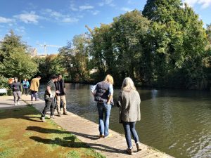
The Summit also gave us the chance to show attendees our volunteers’ work on the River Wandle at the National Trust-owned park. About a dozen people donned waders to cross the river and head to the main park for a guided river wade to see how our volunteers have turned a straight river into one flourishing with wildlife. Participants also had the chance to remove pennywort from the river next to Morden Hall, appropriately during Non-Native Invasive Species Week, which highlights how plants and animals that have come into our rivers cause them harm.
Click below to hear Bella’s full speech about the road run-off solution.
Lou Sykes, our Catchment Officer for the River Loddon, has recently recruited volunteers to undergo training for riverfly monitoring on this catchment for the first time. In this blog, she emphasises the importance of this monitoring, details what volunteers should be looking for and puts out a call for more volunteers across our wider river networks.
This year, the Loddon Catchment Partnership is focusing on investigating poor sources of water quality. We at the South East Rivers Trust (SERT) have conducted riverfly volunteer training to educate the public about freshwater invertebrates, as these creatures can serve as indicators of pollution.
Twelve volunteers have completed the riverfly monitoring training and are now regularly conducting surveys on the upper Loddon near Basingstoke to initiate the riverfly regime in this area. They are now part of a nationwide initiative to assess water quality in rivers. By consistently monitoring the river, they can identify reductions in water quality and report potential pollution issues to the Environment Agency.
So, what are Riverflies?
Volunteers checking a river sample for an RMI survey
They are tiny creatures that live in our rivers (hopefully!). Creatures such as mayfly have an evolutionary history going back hundreds of millions of years. They will spend most of their life in the water as nymphs or larvae feeding on plant life or algae.
They do important work, such as keeping things clean or stopping the build up of too much detritus.
Others are predatory and feed on other aquatic invertebrates. Some make cases from leaves, twigs, tiny pebbles and sand, acting as little underwater architects.
Others cling to rocks in faster moving waters. Some create little shelters in rocks and build little nets out of silk which they produce to catch food as it passes by.
Why are riverflies important?
Riverflies are often referred to as the canaries of our rivers as they are excellent biological indicators for monitoring water quality. The canaries reference comes from an era when mining for coal was a prevalent industry in Britain: canaries would be sent down mines before humans to test how toxic the air was. If the birds died, it was not safe for minors to enter.
Similarly, riverflies are sensitive to pollution, so finding them in the water gives us an indication of the state of the river. With Rivers Trust statistics showing that only 15% of rivers in England are rated in good overall health, riverfly monitoring is a valuable way to test the continued health of a stretch of river.
A polluted section of the River Loddon
Riverflies live comparatively long lives as nymphs or larvae on the riverbed and are relatively localised within the waterway. The types of riverfly you can find vary based on habitat diversity, flow rate, water level and water quality, so you can tell how your river is functioning based on the groups that you find.
Monitoring for riverflies is a nationally important citizen science initiative (known as RMI), developed to monitor the health of rivers and to detect potential pollution events.
The Riverfly Partnership is a network of organisations, representing a wider range of stakeholders from anglers and water course managers to conservationists and relevant authorities that are looking to protect the water quality of our rivers and conserve riverfly habitats.
How do we survey for riverflies and what are we looking for?
We survey for riverflies using a kick-sweep sample. Essentially, this involves kitting up in a pair of waders, grabbing a net and getting into the stream to ‘kick’ the riverbed and disturb the gravels to knock invertebrates living on them into your net. Your net is also swept through submerged vegetation to capture any invertebrates living in those, too. These, plus a hand search of large rocks or any other items that can’t make it into your net (yes that does occasionally mean the odd shopping trolley) make up the sample you look at.
This goes in a tray on the bank to be analysed, looking to estimate numbers of three key groups of riverflies: the up-wing flies or mayflys (Ephemeroptera), caddisflies or sedges (Trichoptera), and stoneflies (Plecoptera). We also assign freshwater shrimp (Gammarus) to this category too.
What’s next? Sign up to help!
A riverfly monitoring tray helps volunteers count numbers and types of samples
Having empowered our new volunteers on the Loddon, we are looking to expand and recruit more people to help monitor the health of rivers.
We have already lined up more training later this summer, for another group of volunteers on the Loddon catchment, giving more people the thrill of knowing they are contributing to vital data.
Would you like to know more about the creepy crawlies living in your local river and what they show with regards to water quality? Could you spend a few hours each month monitoring a stretch of river?
We are interested in building a picture of potential volunteers, for whom we can design opportunities. Please get in touch on the below form to register your interest, so that we can understand how many people might want to be trained as riverfly monitors and where they are from.
Debating the issues affecting waterways, showcasing our river restoration and demonstrating how to remove invasive non-native species will be among contributions by the South East Rivers Trust at the UK River Summit on Tuesday 21st May.
The event, from 9.30am to 7pm, will bring together international environmentalists, businesses, organisations who protect rivers, plus the public at Morden Hall. The grounds of this National Trust property has the River Wandle, a precious chalk stream, running through its park.
This south London river has special resonance for SERT, which began as the Wandle Trust in 2002 – and our Co-CEO Dr Bella Davies will be among the speakers on the opening panel.
In the morning session, Dr Davies will be sharing the floor to discuss the importance of rivers and their challenges at the second ever annual UK River Summit. The event has been designed by Zambuni Communications to bring the public and thought leaders together.
Dr Davies will be sharing the floor with panelists including campaigners such as Fish Legal’s Penny Gane and actor Jim Murray (The Crown) representing Activist Anglers.
Our staff will be leading a river walk
In the afternoon, campaigners, representatives of water companies and politicians will come together to debate and hear about issues affecting rivers. Topics include The Freshwater Emergency, the Future of Farming and Effective Policy in Rivers.
Our volunteers tackle Himalayan Balsam, one of several invasive species in rivers
SERT will be taking the opportunity to mark national Invasive Non-Native Species (INNS) Week by hosting an INNS workshop alongside the National Trust, who own and run Morden Hall and its park. This will offer expert guidance to give attendees the chance to understand the importance of controlling species such as floating pennywort and Himalayan balsam. These species inhibit our rivers and their wildlife. Attendees will have the chance to learn how native plants can be encouraged to thrive instead along the River Wandle, a precious chalk stream.
We will also be leading in-river guided walks, exploring a section of the Wandle that our volunteers have restored. Summit participants will have the chance to learn about the Wandle’s history, wildlife and restoration work. They will see how this section has benefited from our volunteer work, having been turned from a straight river into a meandering haven for fish and invertebrates.
At the end of the day, SERT Catchment Officer Dr Jack Hogan – also representing The Fly Connection and President of the Wandle Piscators – will be giving a talk on the history of the Wandle.
Various short films will be shown during the day, demonstrating the plight of rivers, including “Wandle: A River at Risk”, a documentary on sewage spills into the waterway.
Dr Davies said: “We are excited to welcome the UK River Summit to the River Wandle in May 2024. The Wandle is a historic chalk stream at the heart of a diverse, vibrant community and it’s especially poignant for the South East Rivers Trust as this is where we began our work in 2022. Since then, we’ve learned that engaging people with river habitats is key to protecting and restoring them. We look forward to supporting the event wholeheartedly.”
Tickets for the event, which runs from 9.30am to 7pm, cost £40 and are available from the River Summit webpage.
Watch the video below to find out how the shape of the River Wandle at Morden Hall Park has changed through our volunteer work.
Robyn Shaw, Education and Engagement Officer at the South East Rivers Trust (SERT), has become the first recipient of a new award that celebrates the life of a passionate supporter of work to promote rivers.
The award has been created by Thames Rivers Trust (TRT) to celebrate the late Peter Spillett, one of their Trustees for more than 10 years, who cared passionately about improving the Thames’ tributary rivers and the wildlife that they sustain.
With rivers facing a breadth of challenges and many children having a disconnect with their local blue spaces, the judges were delighted to be able to recognise the importance of providing hands on river education for children in and by their local rivers.
Thames Rivers Trust CEO Miles Morgan awarding the TRT Peter Spillett Award to South East Rivers Trust’s Robyn Shaw, the first recipient of this prestigious new environmental accolade. Credit TRT
Robyn delivers precisely those opportunities through SERT’s Project Kingfisher education programme. This supports schools to bring curriculum topics such as rivers and local wildlife habitats to life. It gives pupils the chance to get outdoors and connect with their river and the many species of wildlife that require healthy rivers to survive.
TRT’s new CEO Miles Morgan presented Robyn with her award on Saturday at SERT’s official opening of Chamber Mead wetlands in Ewell, Surrey. The 2000m2 wetlands aims to reduce pollution entering the River Hogsmill and improve water quality.
Miles said: “Robyn was nominated by a colleague for her passion and innovation and the positive impact she has made over the last year developing resources and working with schools, groups and families in London rivers. TRT is proud to give this special recognition and congratulate her hard work with students and families across four river catchments in South West London and Surrey.”
Over the 2022-23 SERT financial year from July to June, Robyn delivered 94 sessions to 42 schools, teaching 3,743 pupils in assemblies and outdoor sessions. These have taken place in places along the Hogsmill, Beverley Brook, Wandle and Mole rivers across Kingston, Wandsworth, Sutton, Ewell, Surrey and Merton.
Robyn said: “I am thrilled to win this award, which was totally unexpected. It is very special and humbling to be recognised in the name of someone who did so much for rivers and the Thames Rivers Trust. It means a great deal. I find our work with children and young people so rewarding, so it’s fantastic that other people share the value of helping children understand the importance of rivers and connecting with nature.”
SERT’s Co CEO Dr Bella Davies added: ”We’re delighted that Robyn’s work has been recognised by the Peter Spillett Award. During her time with us, she has really thrown herself into the education role at SERT, coming up with new ways to keep the children engrossed about the wonders of river life and leaving them wanting to know more.”
Peter’s family said: “We are thrilled to see the TRT Peter Spillett award being given to such a worthy recipient as Robyn. Peter was always a strong supporter of work to improve our rivers and would be very proud that such work was being recognised in his name.”
The annual award is now open for this year’s entries and is once again seeking nominations for an outstanding individual who works or volunteers with a Rivers Trust or another NGO delivering projects for the environmental good of rivers in the Thames River Basin.
For more details about our education programmes and the chance to book sessions for schools and youth groups, indoors and outdoors, please visit our education page.
Watch the video of Miles presenting the award to Robyn below.
Hundreds of people attended Saturday’s Chamber Mead wetlands open day, many of them volunteering to start the mammoth task of adding 10,000 plants to the edges of this important pollution filter for the River Hogsmill.
The 2000m2 series of wetlands has been created to divert pollutants, coming from the Green Lanes stream, away from the globally rare chalk stream and will increase the numbers and types of wildlife across the Hogsmill Local Nature Reserve.
Egrets and ducks were already enjoying the wetlands as crowds gathered to hear Dr Bella Davies, Co-CEO of the South East Rivers Trust (SERT), explain the reasons for creating the wetlands in partnership with Epsom & Ewell Borough Council, which owns and manages the nature reserve.
The Mayor of Epsom & Ewell Rob Geleit cuts the ribbon to open the wetlands
The wetlands were then officially opened thanks to a ribbon being cut by The Worshipful Mayor of Epsom & Ewell, Councillor Rob Geleit.
In her speech, Bella explained that the project had been conceived more than a decade ago by the Hogsmill Catchment Partnership. This group of organisations and individuals wanted to address the issues of poor water quality in the Hogsmill. It is one of only about 220 chalk streams worldwide. Clear, cool waters in such streams should provide special conditions for creatures such as trout, eel and water voles to thrive.
“Many years ago we identified the Green Lanes stream was bringing poor water quality in. We discovered there was a whole load of urban runoff coming from Epsom,” Bella said.
“Surface water drains were sending [polluted] water straight from roads into the river – and that included lots of nasty things like hydrocarbons, heavy metals from tyres and catalytic converters and microplastics. In addition, there are misconnected pipes for example where toilets are plumbed in wrongly. People pour items down drains, there are pesticides from gardens – and all that is really toxic.
Volunteers start to plant up Chamber Mead wetlands
“There is another really big impact which came from the sewer storm tank overflows. Further up the Green Lanes stream there are two sewers that come together … and to stop them from backing up into your homes, there is a storm tank system where water flows up and theoretically goes back into the sewer. But in exceptional circumstances it overspills into the Green Lanes stream.
“Trying to fix that is really difficult,” Bella continued. “We worked with Thames Water to make the performance of the storm tanks as best as they could and they have reduced the number of times they spill massively.
“Another option is to clean the water before it goes into the river – and that’s what the wetlands are here to do.”
The public had the chance to added plants to the wetlands
About 90% of wetlands have been lost in the past 100 years, Bella added, and this nature-based solution would bring lots of other benefits. “It might look a bit raw, but it is a great time to see it [before plants are added].”
Trapping the silt in the initial pond was “really important,” she explained, because otherwise that silt smothers the river gravels in the water, restricting wildlife’s ability to thrive.
Contaminants coming from Green Lanes are also cleaned through the plants, before the cleaned water is sent back into the Hogsmill downstream of the popular stepping stones.
Multiple benefits of the wetlands include it becoming an attraction for wildlife such as damselflies and dragonflies, Bella added. It is also “really important” for local climate regulation. Those living near water experience lower temperatures which will be “really important” in hot summers in particular.
A special cake was created by Heidi’s cakes in Carshalton to mark the occasion
“There is also increasing evidence of the importance of nature for health and well being – and that’s amplified when we are near water. It helps decrease stress and also is a really great educational resource,” she added, referencing a new nature trail that has been put up around the site.
Delivering multiple benefits meant SERT, which leads the catchment partnership, has been able to appeal to a wide range of different funders. The development of the wetlands has received funding from The Coca-Cola Foundation, Natural England (through the Species Recovery Programme), the Environment Agency, Surrey County Council, the Rivers Trust, the Zoological Society of London, Garfield Weston Foundation and Thames Water, with in-kind support from the landowner Epsom & Ewell Borough Council. The new wetlands are part of the wider Replenish programme in partnership with the Coca-Cola Foundation and the Rivers Trust. The aim of Replenish is to restore millions of litres of water in this and other local catchments, in turn improving biodiversity.
In total, about 300 visitors through the day had the chance to start the task of putting in vegetation around the wetlands and go on guided walks to hear more about the project.
Family friendly activities such as craft and the chance to explore what lives in the water through riverfly demonstrations were also available. Visitors also enjoyed a fabulous cake, baked to look like a wetland flush with wildlife, created by Heidi’s cakes in Carshalton.
We need your contribution from Friday 3rd to Monday 6th May, for the Spring edition of the Big River Watch.
Volunteers from across our region made a valuable contribution to the Rivers Trust’s first Big River Watch last September – and now your local waterway needs you again.
Whether you are an individual, a family, a group of friends or can organise formal group activities, we need your eyes on rivers to gather crucial data. You or your group don’t need to be a river user, just interested in your water-based environment.
Download this poster for the Big River Watch and encourage others to take part from 3rd to 6th May
We’re inviting all nature lovers across the 12 catchments served by the South East Rivers Trust to download an App and spend just 15 meaningful minutes connecting with nature.
What will you spot? Birds and animals in and around the water or vegetation below the surface can be a sign of healthy rivers. Meanwhile, you may see signs of pollution such as coloured water.
In September 2023, we were delighted that 223 surveys were submitted from across our region – stretching from Reading to Dover and down to Hastings – for the first UK and Ireland-wide survey.
There were a total of 3,600 surveys, with 5,871 people getting involved – 60% of them saying they were new to citizen science. So you don’t need experience, just enthusiasm and a love of nature.
Across our dozen catchments, 53% recorded at least one sign of pollution such as algae, livestock and road run-off, sewage and silt. UK and Ireland wide, 54% of people spotted some kind of pollution, but 73% felt their river looked healthy.
We know that looks can deceive, because across England and Ireland not a single river is classed as in good chemical health. Just 15% of river stretches in England are in good overall health. Chemical and nutrient pollution can be hard to identify, but can be very harmful to the life within the ecosystem. It can also hinder wild swimming and paddling and put people off using rivers for canoeing and other recreational activities.
A four day period including a bank holiday gives you and your groups plenty of time to take just a few moments along your nearest river to complete this biggest ever survey about them. The results will supply us with the data to locate the issues, pinpointing the priorities to improve our precious waterways.
As our handy map that helps you find your river shows, our area is wide, covering Berkshire and parts of Hampshire, Surrey, south London, Kent and much of Sussex.
So galvanise your group – residents associations, ramblers or youth group – and spring into action! Why not circulate the poster (attached) to encourage others?
The campaign again will be asking you how your local river makes you feel. Previous responses ranged from calm, happy and relaxed to concerned and sad at the state that rivers are in.
Last time you also submitted pictures of what you saw – from the good, to the bad and the bikes! Beautiful sunsets contrasted with the litter that was sadly often evident.
The South East Rivers Trust (SERT) is inviting local residents to come and celebrate the newly-created Chamber Mead wetlands with a day of family fun, activities and guided tours.
The celebration day on Saturday 20th April will give nature lovers the chance to add plants to this critical pollution buster for the River Hogsmill, a precious chalk stream.
Families will also have the chance to learn about the health of the river by taking part in riverfly demonstrations, a scavenger hunt and nature craft activities. Guided tours of the wetlands will also be part of the day, which runs from 11am to 3pm.
The open day begins a fortnight of planting opportunities for schools and community groups. All the plants have been specially selected to absorb pollutants and attract pollinators and an increased range of wildlife across the Hogsmill Local Nature Reserve.
An aerial view of Chamber Mead wetlands
The wetlands in Ewell now divert urban pollutants from the Green Lanes Stream away from the Hogsmill, one of only 200 chalk streams in the world. Once filtered water is fed back into the river just downstream of the famous Stepping Stones, another 5km of waterway is protected as it flows into south London all the way to the Thames.
Dr Bella Davies, Co-CEO of SERT, said: “We’re thrilled to be giving the community the chance to learn all about Chamber Mead wetlands and crucially give people the chance to complete the project. The public have been very supportive of the wetlands from the start and adding plants is a wonderful opportunity to attract new wildlife not only to the water but the wider nature reserve. This will fulfill the potential of the wetlands to become another jewel in the crown of the reserve and make it an even bigger asset for the community. We’re excited to see the results in years to come on the Hogsmill, which should be a haven for brown trout, water voles and native crayfish, among other species which need our help in recovering their numbers.”
Councillor John Beckett, Chair of the Environment Committee at Epsom & Ewell Borough Council, said: “We are overjoyed to be able to join SERT on the Chamber Mead Wetlands Open Day, to celebrate the fantastic work that has been done here to boost biodiversity and reduce pollution in the Hogsmill River. I hope that residents will join us to help complete the project, which will ensure the Hogsmill River Local Nature Reserve is a place where wildlife and nature can thrive, and one that we can enjoy for many years to come.”
An example of wetlands planting
Supported by the Hogsmill Catchment Partnership, the project has received funding from The Coca-Cola Foundation, Natural England (through the Species Recovery Programme), the Environment Agency, Surrey County Council, the Rivers Trust, the Zoological Society of London, Garfield Weston Foundation and Thames Water, with in-kind support from the landowner Epsom & Ewell Borough Council. The new wetlands are part of the wider Replenish programme in partnership with the Coca-Cola Foundation and the Rivers Trust. The aim of Replenish is to restore millions of litres of water in this and other local catchments, in turn improving biodiversity.
The public can meet the South East Rivers Trust and other partners for the activities at Green Lanes, Ewell, Surrey KT19 9SZ.
Speeches to officially open the wetlands will take place from 11.30am to noon. These will be by Jackie King, Chief Executive of Epsom & Ewell Borough Council, Dr Bella Davies, Co-CEO of the South East Rivers Trust, and The Worshipful Mayor of Epsom & Ewell, Councillor Rob Geleit, who will also cut the ribbon to officially open the wetlands.
Dr Lewis Campbell, one of our Catchment Managers, reports how we have introduced a modern method of assessing what’s in rivers to our armoury.
Traditionally, a variety of methods have been used to evaluate biodiversity and to understand whether or not a specific species is in a particular place in the countryside. When it comes to fish, for example, these survey methods might involve the use of nets or electrofishing equipment. For mammals, methods can involve field surveys looking for footprints, droppings, burrows and dens, or installing hidden cameras that are automatically triggered with movement. When studying birds, ecologists might spend time in the field searching for visual signs or identifying different species by their calls.
Our work seeks to help trout recolonise the Hogsmill. Picture via Canva
For smaller creatures, such as amphibians, reptiles and even invertebrates, various types of traps can be deployed so that the animals can be collected and counted before being released again.
One thing that this diverse set of methods all have in common is that they require a large amount of time to be spent on site. More recently, conservationists have begun to use environmental DNA, or eDNA for short, as a tool to understand species distribution. As animals go about their daily lives, they are continually shedding cells into their environment. These cells might come from their hair, skin, saliva, or even their waste, but they all contain the genetic material (DNA) belonging to that animal within their nucleus. This is environmental DNA.
Rivers could be compared to a soup containing cells and DNA from all of the organisms that live in or near by the water.
Simply by collecting a water sample, we can gain a snapshot of all the animals that were in the local vicinity at the time. We pass river water through an extremely fine grade filter, then generate and analyse the genetic sequences that the sample contains. A single water filter sample can reveal the presence of hundreds of different species from right across the animal kingdom.
eDNA is quite a modern technique. The first example to detect species in a freshwater environment was in 2008, when French researchers used the technology to detect invasive American bullfrog. Since then, technology and its potential applications have improved and expanded rapidly.
Preparing to take a sample to find out the DNA of the Hogsmill
The analysis portion of this work requires numerous pieces of cutting edge technology and very powerful computers, but collecting a water filter sample is very straightforward and quick. This means that it is possible to comprehensively survey the biodiversity at a location much more efficiently than is possible using many traditional methods.
The only major drawback of eDNA surveys is that they can currently only provide information on whether a species was or was not in a given location but not how many were there. For example, using eDNA you could say “I did detect salmon in my river” but not “there were 50 salmon in my river”.
This means that it is a particularly powerful first pass tool for determining presence or absence of a species, which would then by followed up with more targeted traditional surveys. Therefore, eDNA will never replace the valuable work of professional ecologists, but is certainly a very important emerging tool in the conservationist’s arsenal.
At the South East Rivers Trust we are beginning to use eDNA to understand the biodiversity in our rivers before, during, and after our restoration work. This is critical to developing an understanding of whether or not the projects that we undertake are having the desired positive outcomes for the wildlife that call our rivers home.
An important example of this type of baselining is our WET Hogsmill. This is funded by Natural England and aims to kick start the recovery of several species of concern in the River Hogsmill in South West London.
These species – water vole, European eel, and brown and sea trout – are imperiled across our river network, but all of them historically called the Hogsmill home.
The presence of water voles was detected in the Hogsmill by eDNA. Picture via Canva
Our WET Hogsmill project will enhance the river to make it more accessible and more useable for these species, aiding their recolonisation of the river. Environmental DNA is a great tool for us to demonstrate where these species are living along the river. The aim is that over time this will document increases in the numbers of places where specific species are found along the river.
So far we have undertaken a baseline eDNA survey at several points along the Hogsmill, from near its source, to its confluence with the Thames at Kingston. We collected water samples that were used to detect a wide variety of vertebrate species. We found mammals including red fox, grey squirrels, and wood mice. We detected fish including barbel, chubb, stickleback, and many others. We also found birds including the majestic kingfisher, grey heron, magpie, moorhen, coots, and parakeets.
Importantly, we also detected the presence of eel, water vole and brown trout at locations on the Hogsmill, so we know those species are present and we hope that our work will help them to become better established on the river.
The initial survey’s results can be found on our Storymap and we will continue to monitor the river with annual eDNA surveys – so watch this space!
Customers at nine Tesco stores across Banstead, Epsom and Leatherhead can vote to help the South East Rivers Trust inspire children to love the River Mole and spark lifelong interest in wildlife.
The river charity’s popular education sessions set 3,700 pupils on the path to nurturing nature in the 2022-23 academic year.
Now, the programme is developing its reach by engaging schools and youth groups across the River Mole area, which stretches from Crawley through Dorking and Molesey to the River Thames.
Shoppers can help support young people learning about the wonders of river wildlife, by voting for the “Welly Wanderers – River Education” option in participating stores between the start of April to the end of June.
Children who are connected to nature are happier, healthier and more motivated to learn, the charity believes. Feedback on the curriculum linked sessions shows the power of outdoor education and the thrills experienced by the children.
One teacher said: “It was lovely to see several students who struggle to engage in a classroom setting getting really into the learning on offer outside of the classroom!”
A pupil added: “It was awesome, going in the river and seeing all the creatures that live there.”
Typically, pupils on a river dipping session might find shrimps, mayfly or damselfly nymphs or even a water hoglouse, while learning about birds such as kingfishers which thrive near water.
Polly Penn, Head of Working with Communities at the South East Rivers Trust, said: “We are delighted to have been chosen as a Tesco Stronger Starts community project because we know from our education sessions that children love the chance to visit the river. They are always inspired by being able to see for themselves the creatures they have learned about in the classroom.
Children record their findings on the River Mole in a South East Rivers Trust education session
“We believe our sessions will be hugely valuable to pupils in the short term, helping them learn about the value of water and to use it wisely, as well as the long term. As we wrote in a blog about our existing education sessions on the Mole, pupils who learn outdoors develop fantastic personal skills and an increasing number of future careers will focus on climate issues. Our education programme sits perfectly within Science, Technology, English and Maths (STEM) learning and we hope shoppers will take this opportunity to support our work.”
Customer votes will decide how three chosen charities will receive awards of £500, £1,000 or £1,500.
The nine stores where customers can vote for SERT between April and the end of June 2024 are:
Ewell Express, KT17 1PG
Epsom Station Express, KT19 8EU
Epsom Horton Express, KT19 8SP
Epsom Ruxley Lane Express, KT19 9JS
Craddocks Ashtead Express KT21 1QJ
Leatherhead Oxshott Road, KT22 0EF
Bookham Express, KT23 4AD
Banstead Express, SM7 2NN
Epsom Fir Tree Road Express, TW14 8RX
Tesco’s Stronger Starts – previously known as Tesco Community Grants – has already provided more than £110 million to more than 60,000 projects across Britain.
A South East Rivers Trust school session at Grattons Park on the River Mole
This £5m Stronger Starts grant programme, delivered in partnership with Groundwork UK, helps schools and children’s groups provide nutritious food and healthy activities that support young people’s physical health and mental wellbeing, such as breakfast clubs or snacks, and sports equipment for after school clubs.
Claire de Silva, Tesco UK Head of Communities and Local Media, said: “Helping schools and children’s groups access the food and resources they need is vitally important in getting children a stronger start in life. Children with enough food have more energy, better concentration, and ultimately achieve more too.”
Graham Duxbury, Groundwork’s UK Chief Executive, said: “As a community charity, we have seen first-hand how schools and other groups supporting young people have been playing a much bigger role in ensuring children are getting a healthy start to the day and getting access to spaces and services to support physical activity and mental health. Family budgets are tight and school budgets are tight, but it’s so important that children stay fed, fit and focused, so we’re delighted to be able to prioritise these activities alongside Tesco with the Stronger Starts programme.”
Funding is available to community groups and charities looking to fund local projects that bring benefits to communities, particularly those helping to provide food and giving children the support they need for a good start in life. Anyone can nominate a project and organisations can apply online. To find out more visit tescoplc.com/strongerstarts
For full details of SERT’s education opportunities for schools and youth groups and to book visit our education page.
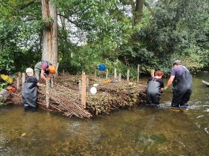
Assistant Project Officer Luke Beckett reports on a week-long series of events with volunteers in mid-March, putting gravel into a stretch of a River Loddon tributary to improve conditions for river wildlife.
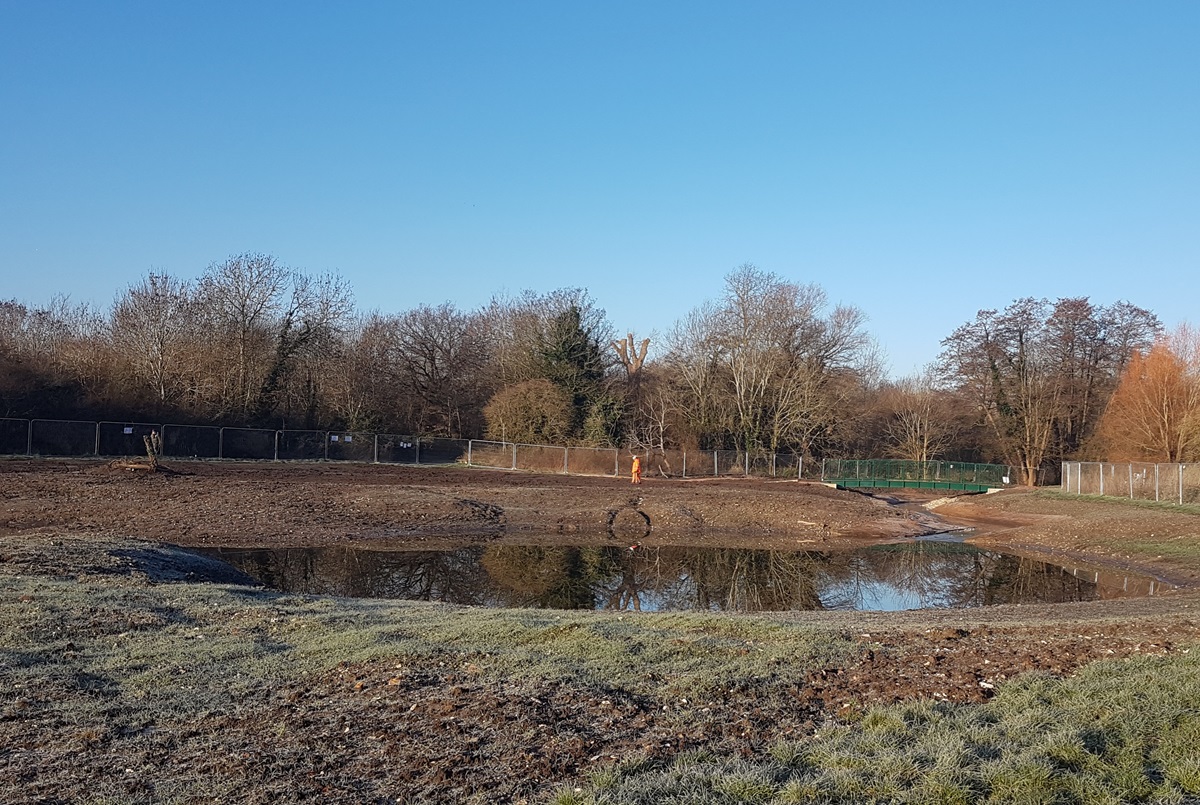
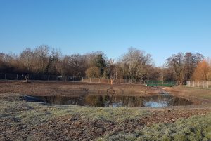
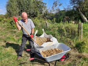
Anglers and conservation enthusiasts were among more than a dozen volunteers who joined us for the exhausting but rewarding task of installing more than 19 tonnes of gravel into the River Blackwater. In joining us earlier this month, they added a vital resource to help nature thrive into a 200 metre stretch of the river in Aldershot.
The newly seeded gravel, which is the final part of our Blackwater Valley river restoration work, will provide improved habitat for macroinvertebrates such as beetles, dragonflies and mayflies. It will also help aquatic plants thrive, as well as increasing spawning habitat for fish.
The River Blackwater at Ivy Road has historically suffered from bank and riverbed modifications. This section of the River Loddon catchment has been widened and deepened, leaving a uniform channel with little variation in water depth.
The channel has lacked flow energy and habitat diversity and subsequently, silt and fine sediments had built up, smothering the riverbed. Moreover, the site is just downstream of the Aldershot sewage treatment plant, which regularly discharges sewage effluent into the channel.
Since 2021, the South East Rivers Trust has worked with support from the Environment Agency and the Blackwater Valley Countryside Partnership, plus local volunteers, to improve this stretch of river.
The in-channel deflectors and berms previously installed have helped to narrow the channel and increase water flow velocity, as well as habitat complexity. The increased velocity has already cleared much of the fine sediments and silt.
The newly-seeded land-based gravel will move around with the natural ebb and flow of the river, settling to form natural river features, such as bars, riffles and deeper pools.
This clean gravel and variety of river habitats is essential for river life: the River Blackwater supports a number of fish species – such as chubb, roach, perch, dace, gudgeon and rudd – all of which should benefit from this improved spawning habitat.
Gravel seeding is not the most glamorous of tasks. This site delivery was no different and was made difficult by the lack of access routes.
Large vehicle access to the river was not possible, which meant a lot of moving wheelbarrows loaded with heavy gravel from our drop off location to the channel itself.
The distance was at least 75 metres and up to 200 metres to push the gravel to the correct places, making this tough physical work. Wader wearing volunteers also had to rake the gravel once in the riverbed, sometimes having taken it to an appropriate location in a dinghy.
It was slow going at times, leaving us questioning whether the gravel pile was even going down! But, after four days, including a lot of rain, not enough sunshine and many teas, coffees and biscuits, the gravel pile was finally gone and the last wheelbarrow and boat load were emptied.
The team took a moment to look over their hard work from Ivy Bridge, where a few curious fish were already checking out the new riverbed, before the heavens opened once again!
This brings our river restoration work at Ivy Road Recreational Ground to a close, but we look forward to returning over the coming months and years to see how the channel responds.
Volunteers will have the chance to help revitalise wetlands in Riverside Gardens, Bromley, for river wildlife thanks to a grant from the Mayor of London.
The Riverside Gardens Wetland Restoration project will be managed by the South East Rivers Trust (SERT) in partnership with the London Borough of Bromley and local community groups.
It aims to improve water quality and habitat in the headwaters of the River Cray, the prime chalk river of outer, south east Greater London which rises in Orpington.
Announced on Wednesday (13th March), the Bromley project is one of 21 that will receive a grant from the Rewild London Fund.
This is aimed at making the capital more resilient to climate change by improving 40 Sites of Importance for Nature Conservation (SINCs).
Currently, this stretch of the river suffers from high sediment input which is detrimental to chalk streams and its wildlife, and the wetland is choked with scrub. The project, supported by the Mayor of London in partnership with the London Wildlife Trust, will reprofile the inlet channel and the online wetland and add a new sediment trap to prevent sediment being released downstream. This will increase the water quality and flow to support aquatic vegetation, fish and river invertebrates.
Part of the site for the Riverside Gardens project in Bromley
Volunteers will have the chance to plant up the reprofiled wetland, using a selection of native wetland plants.
Petra Sovic Davies, Senior Catchment Manager at SERT, said: “We are delighted to receive funding to help us restore the Riverside Gardens Wetland, especially as it will allow us to involve the local community. It is so vital that residents are involved in being given the chance to look after their local natural space. A thriving wetland not only acts as a magnet for wildlife but also provides a wonderful open space that people can enjoy and where they can learn about the natural world.”
The Mayor of London, Sadiq Khan said: “This new rewilding funding will support the restoration of some amazing spaces in the capital, enabling Londoners to benefit from nature on their doorstep and help us to combat the impacts of climate change.
“I believe that all Londoners should be able to enjoy green spaces and that access to nature is a social justice issue. So I’m doing all I can to ensure that Londoners can enjoy wildlife wherever they are in the city.”
Chamber Mead wetlands and their importance to the River Hogsmill were recognised at the 2024 Edie Sustainability Awards in London last night (6th March).
The wetlands were recently completed in Surrey on a stretch of the Hogsmill just south of London. They will filter pollutants and become a haven for wildlife protecting 5km of the river, which is a rare chalk stream.
Part of the Chamber Mead wetlands with the public bridge in the background
This is a fantastic example of a nature-based solution improving the condition of our rivers. The project has diverted a contaminated tributary into the wetlands, which act as a filter before reconnecting cleaner water into the Hogsmill downstream of the famous Stepping Stones.
One of only about 210 chalk streams in the world, the Hogsmill suffers from urban road runoff, raw sewage discharges and misconnected plumbing that sends drain water directly into the river. A healthy chalk stream’s pure water, stable temperature and flows provide longer growing seasons than other rivers and support important habitat for species such as brown trout and native crayfish.
Creation of the wetlands has been carried out in partnership with Epsom & Ewell Borough Council, which owns and manages the Hogsmill Local Nature Reserve, a popular greenspace which will now benefit from this new community asset.
Bella Davies, Co-CEO of the South East Rivers Trust, said: “We couldn’t be more delighted that the Chamber Mead project has been recognised by the Edie Awards. The project has been more than 10 years in development. It has brought together a wide range of partners and funders to step up and share responsibility for improving water quality in the Hogsmill river, one of the country’s rare and precious urban chalk streams.
Dr Bella Davies at the Edie Awards
“Wetlands such as these are a great way to improve water quality, especially in urban areas, in this case by filtering water from one of the Hogsmill’s headwater tributaries. This water has been contaminated by toxic urban road runoff and sewage from storm tank overflows and misconnected pipes. The water will now enter the Hogsmill after it has been cleaned by the wetlands and help bring back endangered river wildlife such as brown trout and eels.
“We’re also thrilled that the public will see the wetlands develop into a space where wildlife such as dragonflies, birds and butterflies can thrive providing more opportunities to experience nature on their doorstep.”
SERT is now preparing a series of planting days for schools, community groups and the public to take place in the Spring, as well as an open day to introduce the project to the community.
Supported by the Hogsmill Catchment Partnership, the Chamber Mead Wetland project has received funding from The Coca-Cola Foundation, Natural England (through the Species Recovery Programme), the Environment Agency, Surrey County Council, the Rivers Trust, the Zoological Society of London, Garfield Weston Foundation and Thames Water, with in-kind support from the landowner Epsom & Ewell Borough Council.
The new wetlands are part of the wider Replenish programme in partnership with the Coca-Cola Foundation and the Rivers Trust. The aim of Replenish is to restore millions of litres of water in this and other local catchments, in turn improving biodiversity.
Ahead of our first Water Abstraction Group workshop on 25th March, Dr Sam Hughes, Senior Water and Land Stewardship Officer, explains how growers are better working together to secure water for their crops – with major changes on the way.
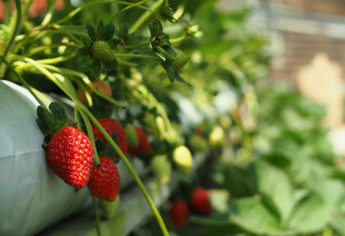
The South East of England, particularly areas such as the Medway and north Kent, is a key sourcing area for fresh fruit and vegetables, grown by the horticulture sector.
Most growers rely at least in part on abstracting fixed volumes of water from the environment under a licensing system from the Environment Agency that began in the 1960s. However, that system needs updating, especially in our region, where water scarcity has been exacerbated by the growing needs of a densely populated area and climate change. We are increasingly subject to the extremes of drought and rainfall.
Therefore the Government has brought in new legislation – namely the Environment Act to help balance the needs of the environment, which needs sufficient quantities of water retained in rivers to thrive, our human needs and those required by growers to ensure food security.
Part of the new legislation supports reform of the amount of water that growers can abstract. The changes could mean that, in the near future, growers might face cuts in the amount of water they are permitted to abstract, which could impact their business and domestic food security. The answer lies in collaboration to have a voice in regional water resource planning, which takes a holistic look at the needs of different sectors.
The rise of the WAGs – Water Abstraction Groups
Growers are already highly inventive when it comes to watering crops. Picture by Tzeemeng Yap via Pexels
Many growers of fresh fruit and vegetables including strawberries, pears, apples and peppers, are already highly innovative when it comes to water, from precision irrigation to rainwater harvesting and storage. However, some growers rely to an extent on drawing water from mains supply to supplement crop irrigation during the peak growing season. This is an expensive option and not necessarily the best for crop irrigation.
As part of a multisector group of water users with diverse needs, the voice of fresh food growers in planning is vital. That voice is stronger when growers work together rather than alone. Water Abstractor Groups – also known as WAGs – provide that much needed collective voice that speaks up for abstractor rights in regional water planning and management processes.
WAGs also mean better dialogue with regulators such as the Environment Agency or Natural England, shared resources and pooled knowledge. By raising awareness about water scarcity, climate change and drought impacts, the members of a WAG can adapt more nimbly to changes in regulations and are generally better informed of opportunities to ensure they get their fair share of water resources.
WAGs are well established in key sourcing areas such as East Anglia, where water, the environment and food security are fundamental. For example, the Broadland Agricultural Water Abstractors Group, formed in 1997, now has 170 members acting as a forum for discussion on sustainable water management and addressing issues of policy.
But is there an appetite for WAGs in the South East? How do they work? How are they set up and what can growers in the South East expect from them?
Our fruit and vegetables require sustainable water management
Now, more than ever, is the time to work together on building sustainable water resilience for businesses that produce our food.
Through the Holistic Water for Horticulture Project (a Courtauld Water Roadmap Project), the South East Rivers Trust is collaborating with key partners to organise two workshops over 2024. These will talk with growers and farmers about the role of WAGs in a collective approach to sustainable water management for food production, in abstraction reform and in regional planning.
These workshops will be held in collaboration with the National Farmers Union (NFU), Water Resources South East, the Environment Agency, established Water Abstractor Groups (WAGs) and regional water companies.
Pollution in the Hogsmill River, by Toby Hull of the South East Rivers Trust
Brace yourselves: 0% of England’s rivers are in good overall health. A truly shocking fact for a habitat that’s so vital to all of us.
This and other alarming statistics come from the Rivers Trust’s 2024 State Of Our Rivers Report, which has been launched today (Monday 26th February).
Combining data, insightful maps, and illuminating case studies, the report dives into the data and evidence, offering us an insight into just how our rivers in the UK and Ireland are doing.
The data is clear:
No single stretch of river in England is in good overall health
Just 15% of English river stretches reach good ecological health standards
Toxic chemicals that remain in our ecosystems for decades pollute every stretch of English rivers
Healthy rivers can be a powerful ally in mitigating the effects of climate change, being able to protect communities from flood and drought, the report emphasises. They support a wealth of biodiversity. They also benefit our physical and mental well-being and are a fantastic way for us to reconnect with nature.
However, these vital ecosystems are plagued by sewage, chemical, nutrient and plastic pollution. They have been heavily modified, so they don’t function as naturally as they should.
All this means that our aquatic wildlife, from plants to fish, is having to work harder to survive – and that rivers can be unpleasant places to visit or to use for recreation.
So, what can you do? Here’s five actions you can take
1 Write to your MP to demand meaningful action
Demand better for your river
If you are shocked by the state of our rivers, write to your MP to demand change.
Tell them that restoring rivers is climate action, supports wildlife and protects communities.
The report allows you to search for your local stretch of river and use its stats and maps on sewage, barriers in rivers and chemicals to arm yourself with facts before contacting your MP.
You can contact your MP via the Rivers Trust’s portal – and add your own words to the template.
Ask your elected representative what they are doing about river health. We want you to demand better Government action for our rivers, through better water quality monitoring, investment in infrastructure for sewage treatment and better funding for Nature-based Solutions.
To help you when you write, we have compiled a State Of Our Rivers Catchment Crib Sheet with a basic comparison of Water Framework Directive ratings for our catchments between 2019 and 2022.
We would also encourage you to speak up for some of our recent work (below) and show how it is making a real difference to rivers.
For example:
Volunteers plant up berms at Morden Hall Park in September 2023
Nature-based solutions such as leaky woody dams are holding water longer in the landscape of the Beult area of the River Medway. This increases biodiversity and helps nature thrive, as well as slows water flow into the main river, where it is abstracted for human use. As those who went on our Nature-based Safari concluded: We need to make more of this happen on a wider scale.
Deflectors and planted berms extending parts of the bank have re-wiggled a straight section of the River Wandle in Morden Hall Park (pictured). This works wonders for wildlife, varying the flow of the water and giving fish and invertebrates places of refuge and areas to breed.
New wetlands constructed at Chamber Mead have brought fresh hope to the Hogsmill. They divert pollution which will help protect 5km of precious chalk stream.
Our Holistic Water for Horticulture project works with growers towards a 2030 target that 50% of the UK’s fresh food is sourced from areas with sustainable water management. The south east is an area already classed as water-stressed and this is an issue that affects our food security.
We’re also working to put rivers at the heart of landowner thinking as part of the Darent Landscape Recovery Project, a Government-funded pilot.
2 Shout out for your local river on social media
Join the fight for healthy rivers
What’s your local stretch of river? How do you use it and how does it affect your mood? Perhaps you visit it for pleasure with your dog on a daily walk, or use it for recreation such as rowing, canoeing or swimming.
However you care about your local river and interact with it, we want you to tell us online. Once you have found out about the condition of your local river via the State of Our Rivers report, make a noise about it!
Report what you see – for good or bad – whether that’s young fish thriving and wildlife flourishing, or plastic pollution and sewage outfall spills.
Use the hashtag #StateofOurRivers and find us on X (formerly Twitter), Facebook and Instagram. Why not tag the elected representative you have emailed, too? You can also tag @TheRiversTrust on all channels.
3 Sign up to be an Everyday River Hero
Whether you are a seasoned, long-term river user or you’ve been caught up in the increasing wave of publicity around sewage and other river issues, we want you to become an Everyday River Hero.
It might be hard to believe given our wet winter, but the south east of England actually receives less annual rainfall than the south of France. We face a real threat of not being able to meet supply by 2050, because of a growing population and climate change.
Launched in January, our 10-week email programme will tell you why rivers are essential for our daily lives and how to care for and protect wildlife, when you are exploring the great outdoors or at home. How – and how much – water you use in your bathroom and kitchen, as well as your garden can be as vital for rivers and the wildlife that thrives in them as the flea treatments you use on your dogs.
We always get a huge thrill when we can involve volunteers directly in work to help rivers thrive. There is nothing like enabling communities to take action for the stretch of water they love.
Help install gravel on the River Blackwater in Aldershot. Join us to improve this stretch of the River Loddon for fish and invertebrates on any of four days, from March 12th to 15th.
Sign up for Outfall Safari training on the Beverley Brook, on 20th. Join us and the Zoological Society of London to learn to spot and report misconnected plumbing that is polluting rivers. The results will help trace appliances such as washing machines that have been connected to the wrong pipes when they were installed.
To book, visit our events page – and bookmark it for subsequent volunteering opportunities during 2024.
5 Book our education sessions for your school or youth group
A school education session
Educating our youngest citizens is a core part of our work on the Beverley Brook, Hogsmill and Wandle rivers, where we hold sessions for Key Stage 1 and 2, in schools and along rivers. Our sessions are available for youth groups, too, so inspire them to cherish their local waterway by booking a session.
We also run school sessions on the River Mole, under the Our River Our Water programme.
If you are a parent or teacher, read our education page for full details and encourage your school community to get in touch!
As one teacher said about our curriculum linked sessions: “They fit exactly with what we have been learning and the children enjoyed all the activities.”
We use cookies to ensure that we give you the best experience on our website. If you continue to use this site we will assume that you are happy with it.OkNoPrivacy policy


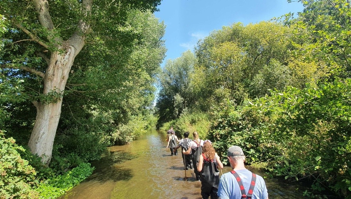
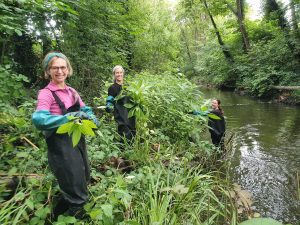

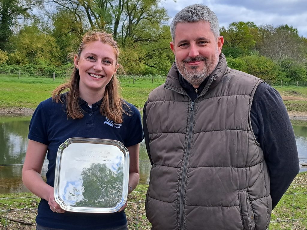
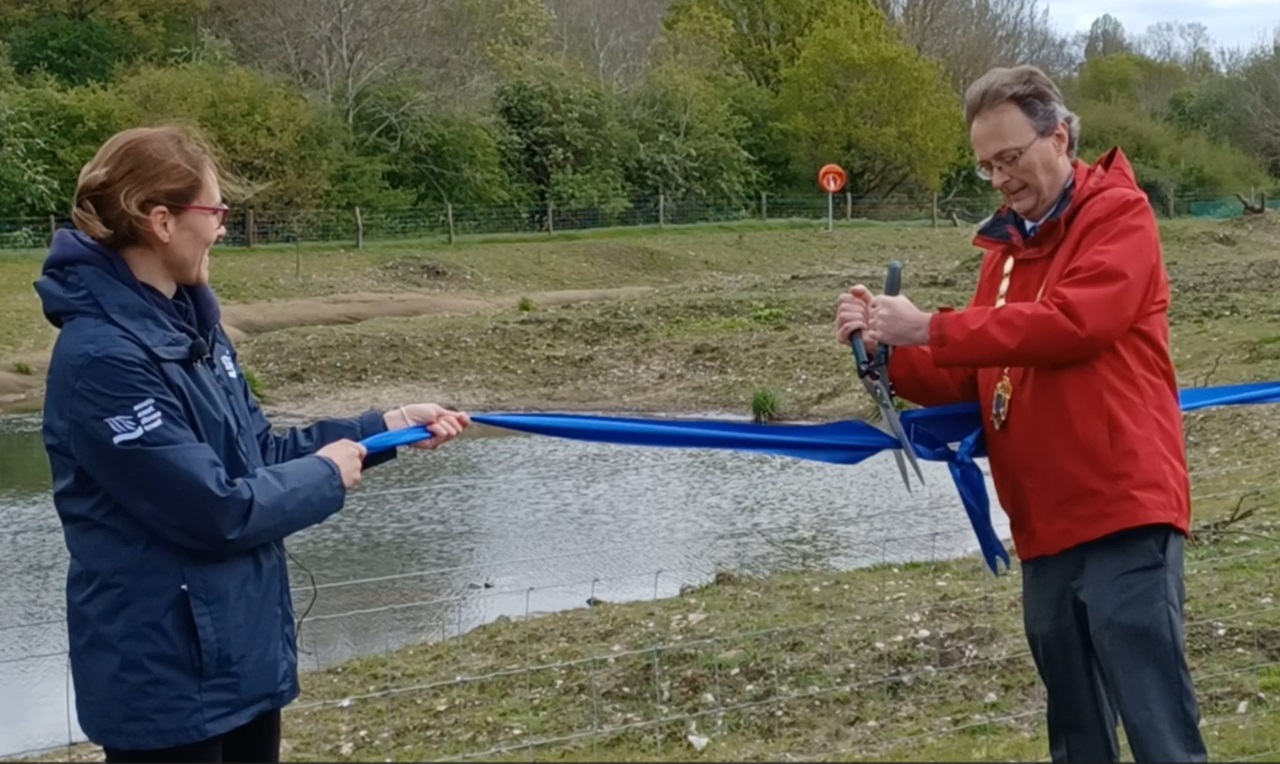

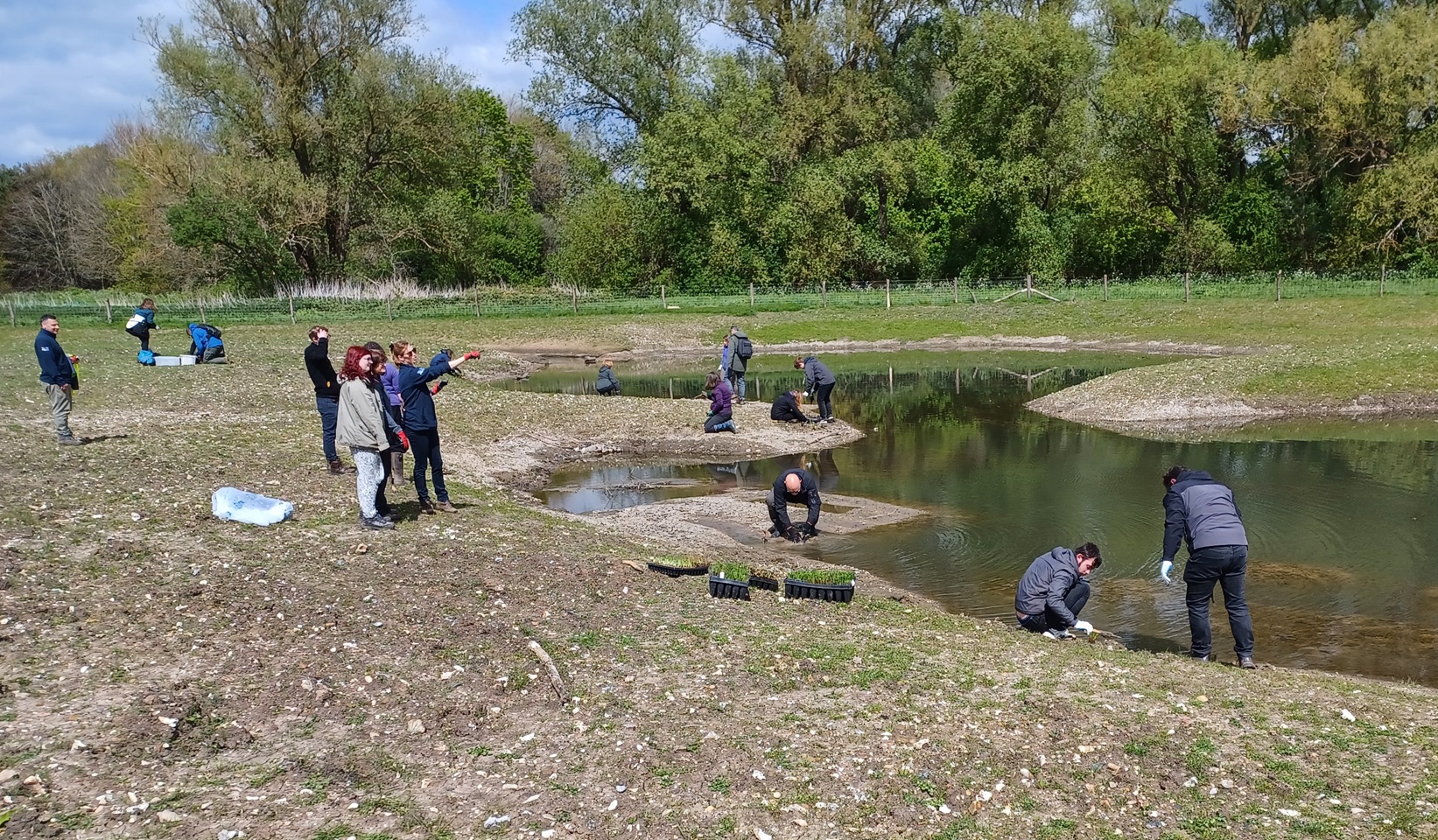
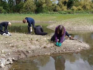
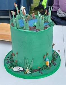
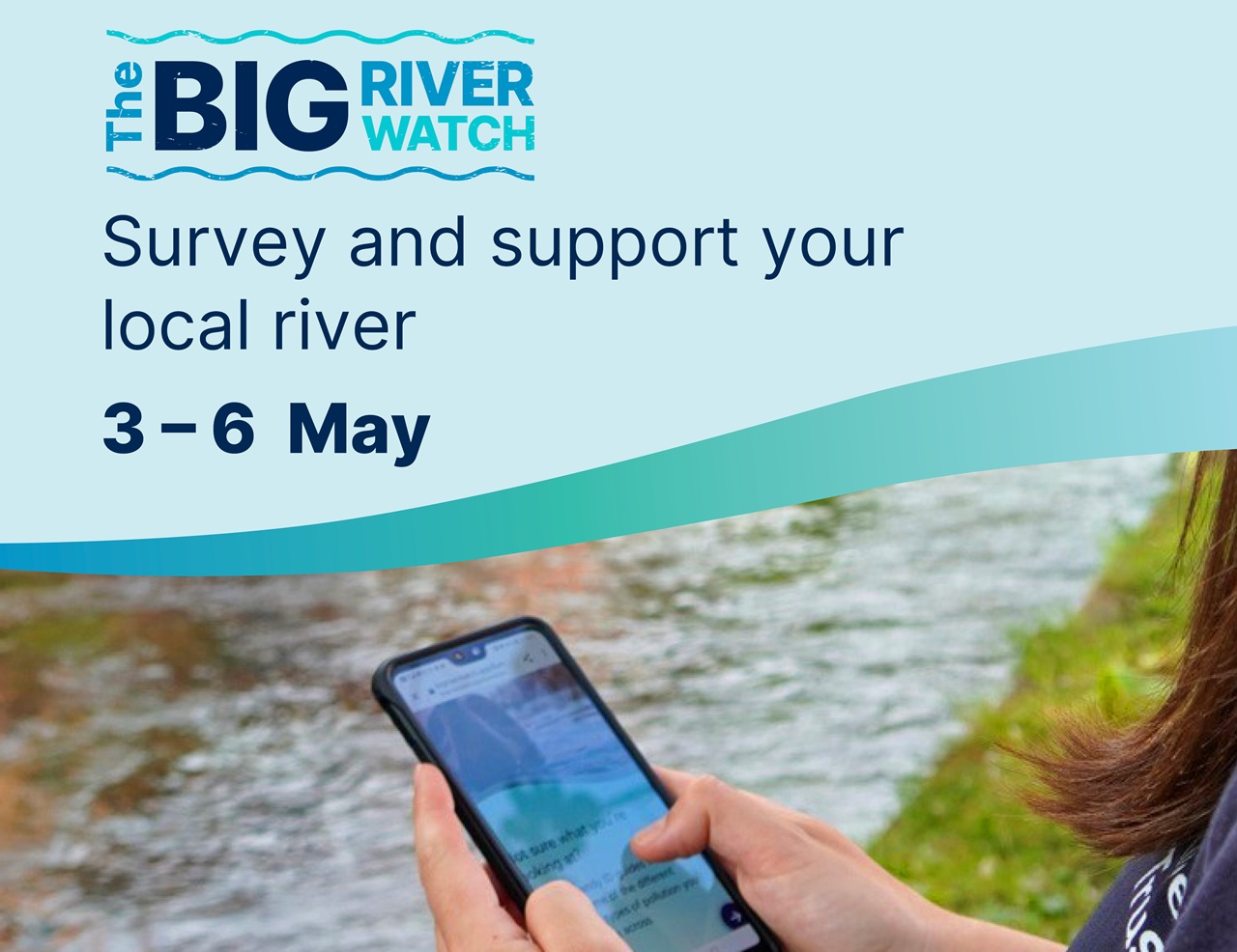
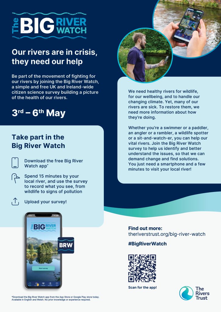
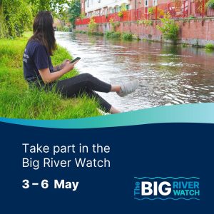
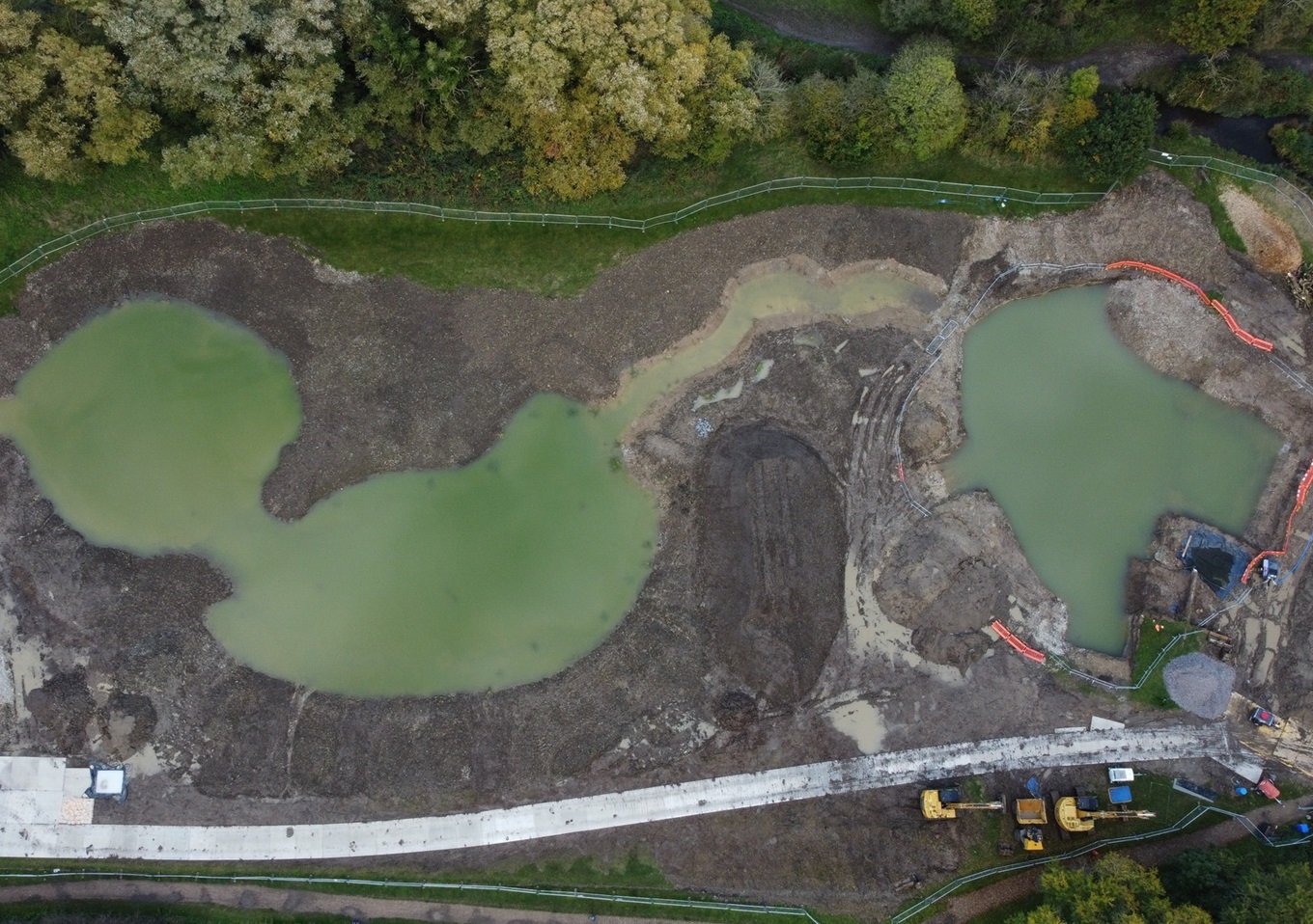

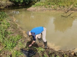

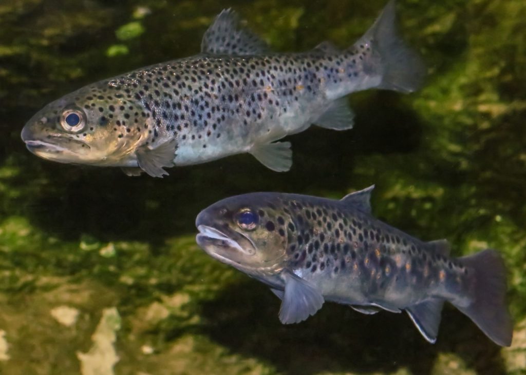
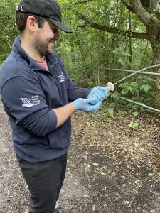
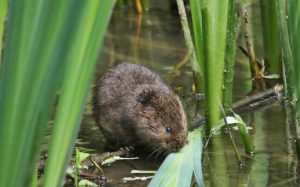
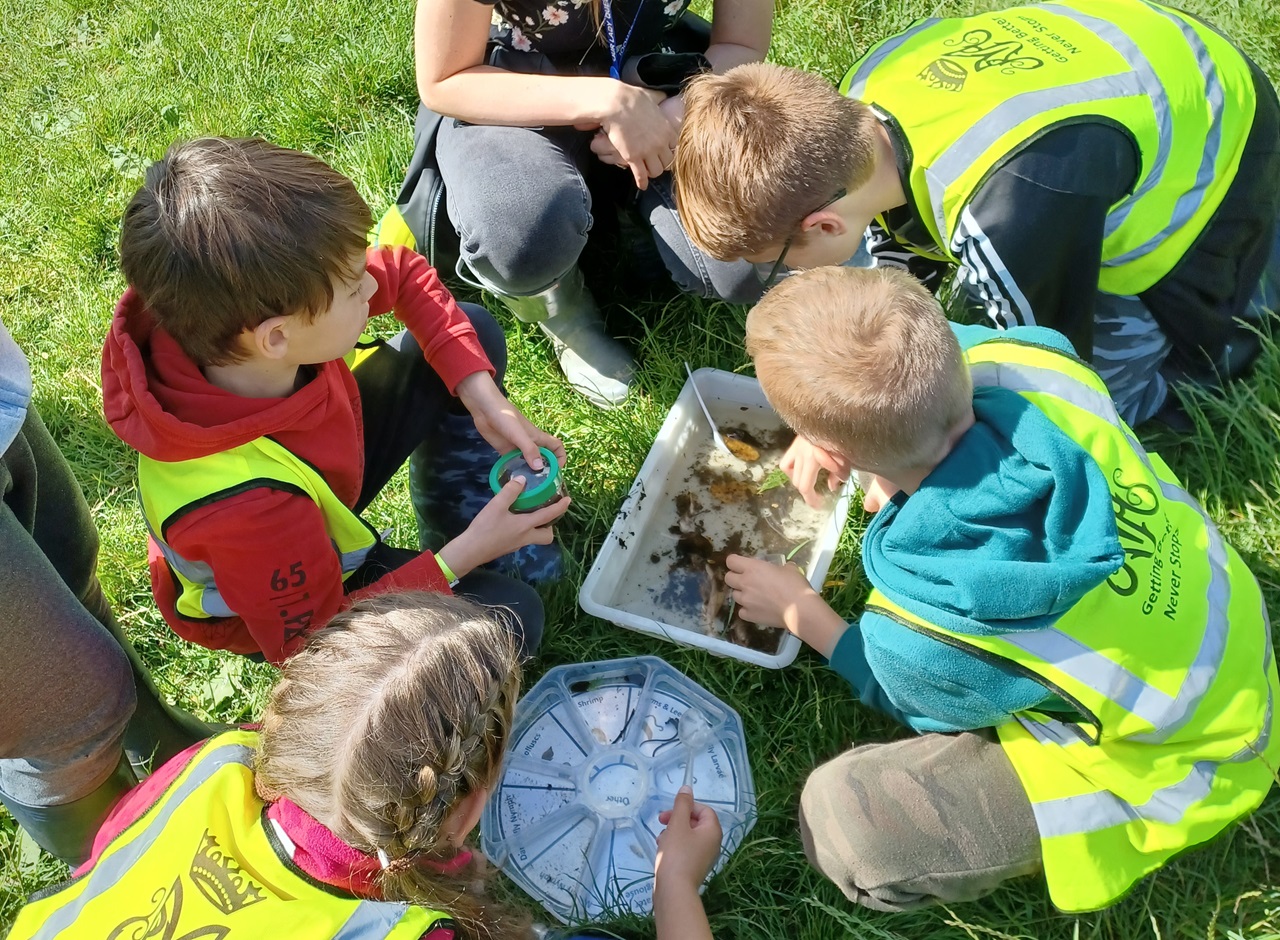
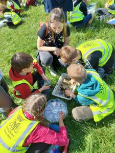
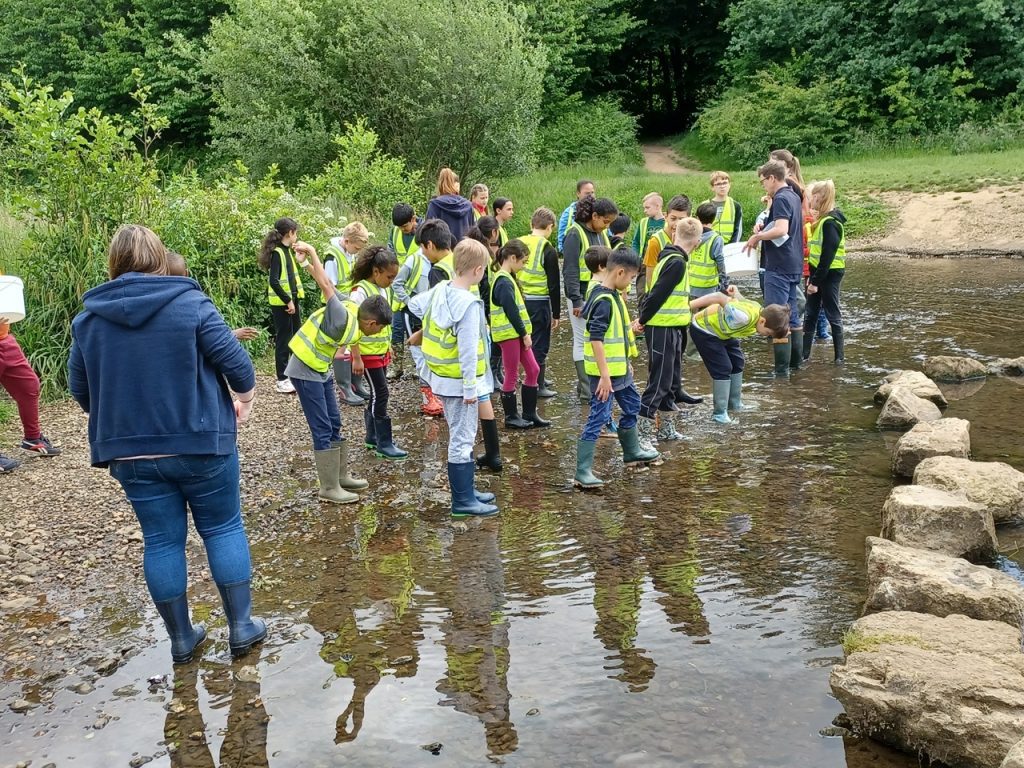
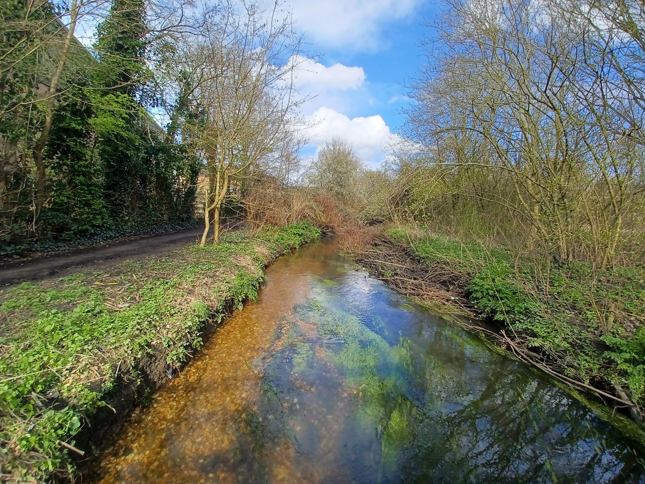
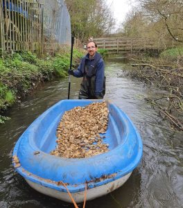
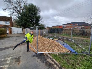
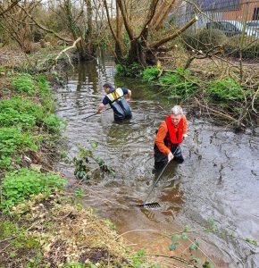

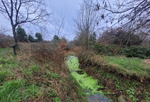 The
The