
The launch of our River Loddon Storymap, on behalf of the catchment partnership, allows residents across the area to see the problems faced by the river and the collective actions of around 20 partners in trying to improve the waterways. Residents can also sign up to join in, as individuals or to join the partnership as a group. Lou Sykes, catchment officer for the Loddon, introduces the new Storymap.
Capturing the work of catchments
Since its inception in 2000 as the Wandle Trust working on one river, the South East Rivers Trust (SERT) has grown exponentially and now cares for and maintains watercourses across 12 catchments in the south east of England.
SERT is also long established in the Beverley Brook and Hogsmill catchments, hosting and chairing the catchment partnerships. These lead a variety of organisations to devise ways to assess the issues faced by rivers and create plans to improve them using the Catchment Based Approach (CaBA).
Our growth is such that we now partially or fully host and chair 11 of the 12 catchment partnerships throughout the south east. This area stretches from the Kent coast to the Sussex coast, meandering through Surrey and encompassing much of Berkshire and north Hampshire.
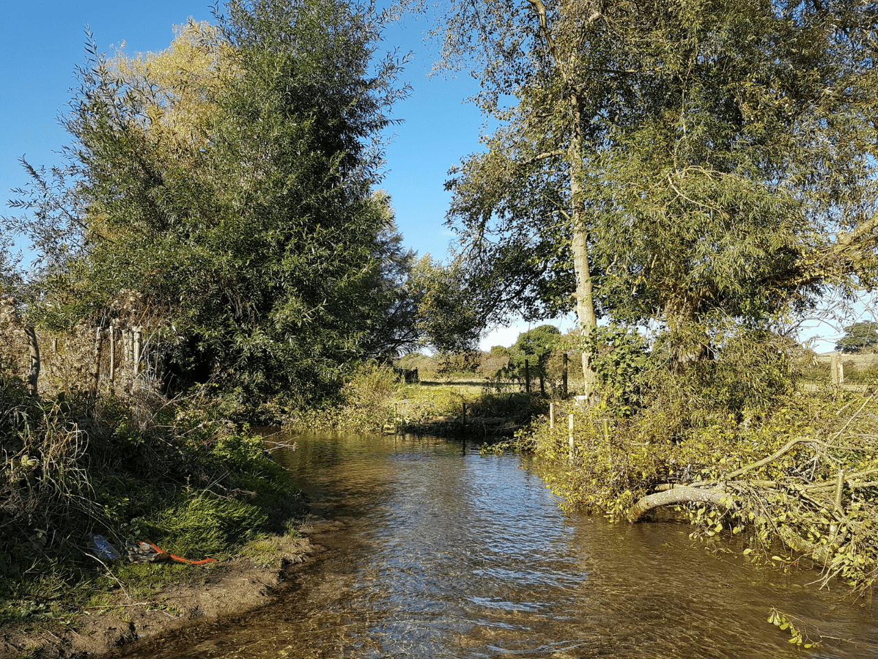
It is for this latter area, the 680 km2 River Loddon catchment, that SERT has now launched a Storymap, capturing the partners, issues and plans to improve the whole network of watercourses. This will be the first in a series of new Storymaps on various catchments that will be released in 2023, funded by Thames Water.
The ArcGIS Storymap portal is a story authoring, web-based application, that enables an organisation to share maps in the context of narrative text and other multimedia content.
Using this facility, SERT’s catchment partnerships can detail the pressures faced by the river networks and introduce objectives for improving rivers and the surrounding areas, as identified by the partnership.
Bringing different groups together to solve the river’s issues
By creating this presence online, the catchment partnership raises awareness and becomes a supportive group, speaking with one voice. In the case of the Loddon catchment, this brings about 20 different groups together: this better empowers collaborative working and helps to ensure all issues affecting the river are noted, captured and addressed under one umbrella. By working together, the catchment partnership can plan and deliver positive actions that will improve the riparian environment across a whole river network, as opposed to working on sections in isolation.
Leading on the Loddon catchment partnership, SERT brings together people from various local organisations and interest groups including water companies, government bodies, local flood groups and angling clubs.
Giving communities and groups the chance to have their voices heard is crucial to the Catchment Based Approach, empowering them with a sense of ownership as the partnership delivers action on the ground.
The Loddon Storymap allows readers to explore the character of the catchment including its tributaries, outlines the issues facing the river, the actions being taken to address them and how to get involved in actions to protect this vast network of water. The maps on the Storymap are ‘live’, meaning that whenever they receive new data they update automatically. Data comes from a variety of different places, with the latest from the Rivers Trust and the Environment Agency showcasing the issues of the catchment.
Maps capture the issues
Summaries of issues affecting the river range from the general to the specific, such as under water quality. Did you know, for example, that road runoff can carry more than 300 different pollutants which can cause short and long-term damage to watercourses?
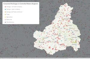
Meanwhile, one of many bespoke maps details the phosphate status of the river network, which rises from chalk-fed streams in Basingstoke and goes all the way to Reading and stretches across to Aldershot. Another map shows the pollution from waste water. Another details the topical issue of sewage spillages.
The extend to which the catchment is affected by flooding, low flows and abstraction is also outlined, with a warning: “The primary risk of flooding in the Loddon catchment is from rivers – and flooding events are being projected to become more frequent and more severe as the climate changes.”
Flood zones and areas most susceptible to flooding, from both rivers and surface water, are shown in another map.
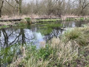
The site also reports the extent to which physical modifications have impacted river health. Like many rivers, the Loddon has been modified over centuries – straightened, widened or deepened – to improve drainage for land, housing, industry and farming.
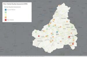
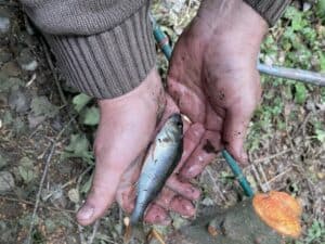
River habitat quality is also shown, with just one area rated as having a truly diverse habitat, according to River Habitat Survey methods. Many areas across the catchment have good ranges of habitat, but others are rated as poor. Another map outlines the results of fish surveys, compiled as indications of river health, allowing readers to click on specific areas.
The issues section ends with a warning: “The number of people living in Basingstoke, Wokingham, Sandhurst, Fleet and Aldershot is rapidly growing and these towns have multiple areas of new development proposed between 2023-2040.
“The south east of England is in the midst of a water shortage crisis. Growing populations together with our changing climate pose a severe risk to the health of our rivers. Many of the challenges faced by our river catchments are likely to be intensified by the demands of a growing population.“
So what can be done?
A key section of the Storymap is the action plan, outlining “natural processes opportunity mapping” that includes the potential for “floodplain reconnection”, for example lowering artificially incised riverbanks, the potential for riverside woodlands and such opportunities across the wider catchment.
Key priorities are to identify habitat improvements, deliver restoration or enhancements, improve fish passage by tackling barriers, keep rivers cool in the face of a changing climate and tackling invasive species.
It also outlines the benefit of natural capital mapping. “Taking a GIS-based catchment approach to understanding the location, condition and potential of natural assets,” the portal says “allows us to target action to protect water resources and communicate change. This enables us to integrate a catchment-scale nature-based solutions approach with water company plans, catchment partnerships, and landowners.”
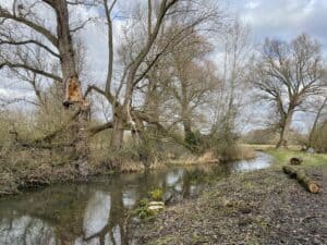
Mentioning work that has been carried out on the catchment so far, the portal highlights Loddon Rivers Week, which takes place every September. Last year, residents witnessed instant improvements after taking part in gravel seeding in Hook and installed large woody materials at Tice’s Meadow and Ivy Recreation Ground in Aldershot. Other work on the Loddon involves a long-standing effort to remove Floating Pennywort and creation of the Charvil Meadows backwater in 2020.
Lastly, the Get Involved section prompts people who see issues with their river to report them to the relevant authority, to suggest enhancement protects, join the partnership as a group, volunteer for events or invest in the river by financially supporting enhancement work.
Whatever you want to know about the Loddon, visit the Storymap and get involved!